
(Netherlands) Jansson, Jan . Amsterdam, ca. 1680. $600.00
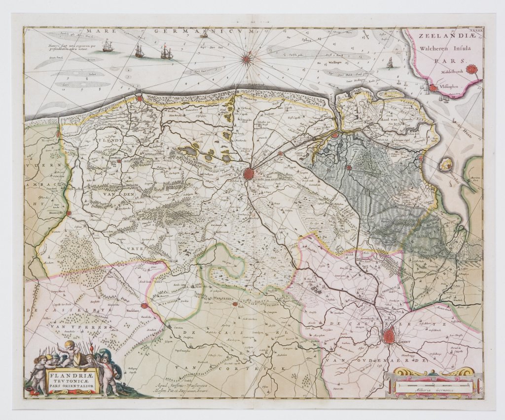
"Flandriae Teutonicae Pars Orientalior"
For one hundred years, beginning in the last quarter of the 16th century, Dutch mapmakers were in the forefront of cartography. Their maps contained the most up-to-date geographical information and were usually elaborately engraved with illustrations surrounding the title area, the scale of miles or elsewhere on the sheet. The Blaeu, Jansson, De Witt and Visscher families were the three most powerful dynasties of mapmakers during this period.
This beautiful and highly detailed map by Jansson after Moses Pitt is in excellent condition with the original vibrant coloring perfectly preserved. Since it was not until the eighteenth century that it became customary to show north to the top of the page, an engraved compass rose indicates the orientation of the map. In this case, north is shown to the top of the page, but angled slightly to the right with the coast of Belgium across the top of the map extending from southwest of the port town of Oostende on the left to the mouth of the Lys River, and inland to Rouselare and Gent. Bruges is shown at the center of the map. The detail is so great that the bike paths to Damme and surrounding towns are shown. This is a remarkably decorative map with many sailing ships, a compass rose, a decorated scale of miles and a group of cupid warriors with spears and shields and a drummer boy surrounding the title at lower left.
20 x 24 inches, sheet.
Hand colored copperplate engraving.
Excellent condition with original hand coloring and full margins.
or click to inquire about this print.