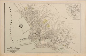
(Oakland, Berkeley, Alameda) Chicago: George Cram, ca. 1890
$95.00
“Map of the City of Oakland, Berkeley and Alameda”
An attractive large scale map showing streets, railroads, ferries, wharves, parks and proposed wharves and “improvements now in course.”
14 1/2 x 22 1/2 inches.
Hand colored lithograph.
Very good condition save dirt in lower margin.
1 in stock

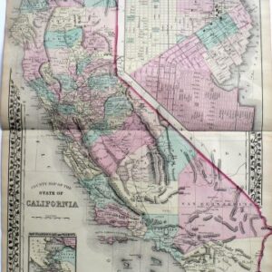
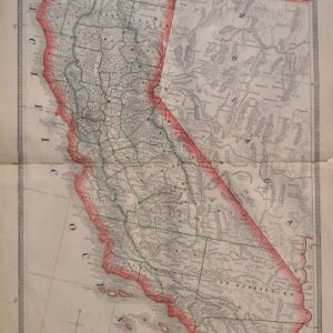
![S. Augustus Mitchell (California) New General Atlas. Philadelphia [1860]-1864](http://fineantiqueprints.com/wp-content/uploads/2025/08/MitchellCalifornia-300x300.jpg)
