
(Pennsylvania) Samuel Lewis after Reading Howell. Philadelphia: M. Cary, 1795. $775.00
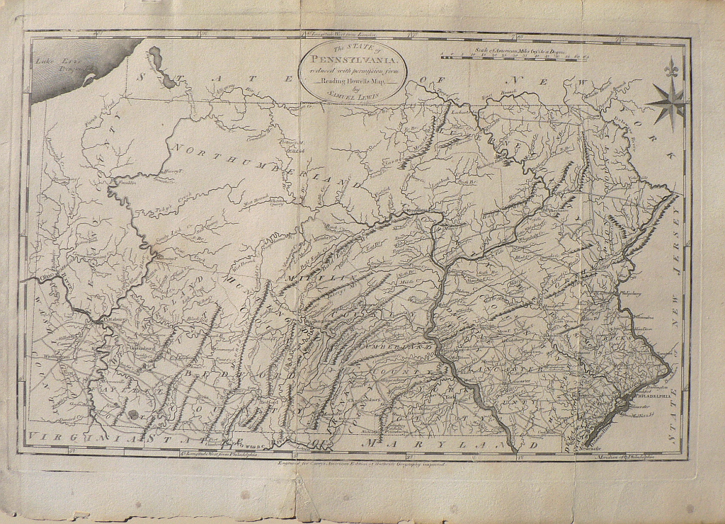
" The State of PENNSYLVANIA reduced with permission from Reading Howells Map by Samuel Lewis"
An important map of Pennsylvania from the American edition of Guthrie's Geography Improved. This atlas was issued in 1795 by Mathew Carey, a seminal figure in early American cartographic publishing, an Irish immigrant, whose home state was Pennsylvania. The map was drawn by Samuel Lewis, a very important American cartographer in his own right. It is based upon Reading Howell’s larger 1792 map which was the best map of Pennsylvania from the eighteenth century and the first detailed map to show its proper boundaries. It was engraved by James Smither, one of the famous cartographic engravers of the time. Topographical information is clearly portrayed as well as depictions of towns, rivers, and roads. Also shown are a few indications of the Appalachian mountains and county borders. Longitude is given both with a prime meridian located in London at the top of the map and at Philadelphia at the bottom. This is an important map of Pennsylvania created by four of the most important figures in American cartography.
14 x 20 inches, sheet size.
Engraving.
Good condition with folds as issued reinforced on verson
Minor shipping of extremities,
or click to inquire about this print.