
S.A. Mitchell. (Cincinnati, Ohio) Philadelphia, 1860. $175.00
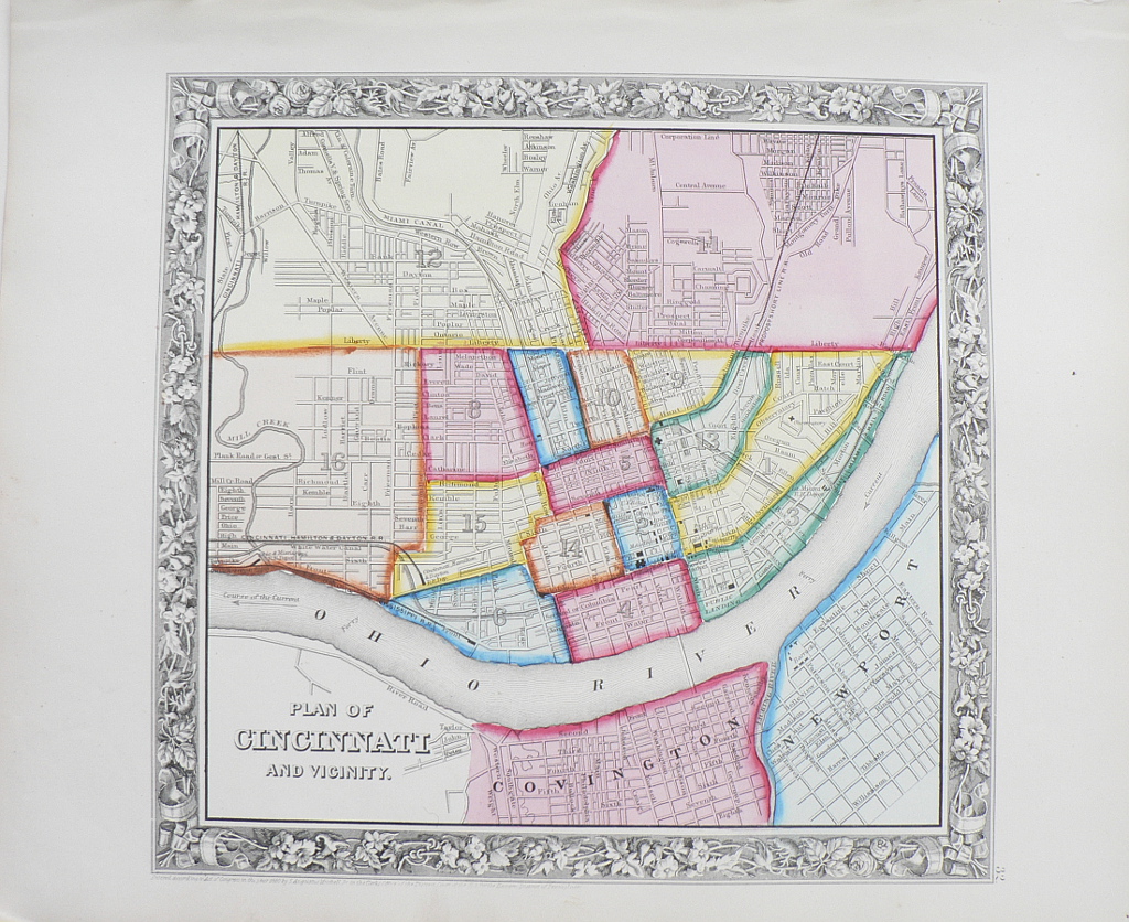
“Plan of Cincinnati and Vicinity”
A vibrantly colored plan of the city and immediate surrounding areas as they appeared in 1860 by one of the foremost publishers of the period. Modes of transportation are emphasized with The “Proposed Short Line R.R”, the course of the Current of the Ohio River indicated, the Cincinnati, Hamilton & Dayton R.R., the Miami Canal, as well as landings and creeks. The map is encircled by an exceptionally beautiful border of flowers, leaves, and ribbons.
12 ½ x 15 ½ inches, sheet.
Hand colored lithograph.
Excellent condition with light patina.
or click to inquire about this print.