
J. H. Colton (Florida and the Keys) General Atlas with Descriptions. Printed New York [1857]-1859. $225.00
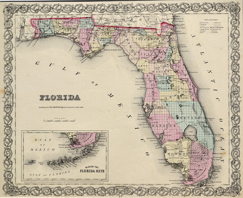
“Florida” with inset “Plan of the Florida Keys”
Wonderful example from Joseph Hutchin Colton’s well received atlas titled, A General Atlas with Descriptions, which contained one hundred seventy steel plate maps and plans, of which 45 document the United States of America. The atlas is a compilation of earlier maps and surveys and is remarkably up to date. Florida became the 27th state in the Union in 1845. Fourteen years later the state is neatly divided into counties with a good amount of interior development. Towns and villages line both coasts east and west and are identified. The Keys are shown in an inset in great detail. The map describes railroads, canals, the state capitol “Tallahassee,” villages, and forts. With full original hand color it is a great document of early Florida.
Steel plate engraving, with full original hand color.
15 x 17.5 inches sheet size.
Matted. Excellent original condition.
or click to inquire about this print.