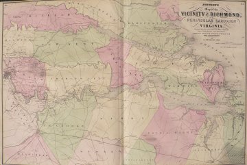
(Richmond and Vicinity...) New York: A. J. Johnson, 1862. $225.00

“Johnson’s map of the Vicinity of Richmond & Peninsular Campaign in Virginia showing the interesting localities along the James, Chicahominy & York Rivers”
A large, detailed and beautifully colored map depicting Richmond on the far left of the map and extending to the Chesapeake Bay and York River on the right. It includes the location of forts, indications of the growth of the development of the towns, railroad lines, and soundings in the rivers. The map was compiled from the official maps of the War Department.
18 x 27 ¾ inches, sheet.
Hand colored lithograph.
Very nice condition.
or click to inquire about this print.
