
J.H. Young, ...Travellers Guide through the United States. Philadelphia: S.A. Mitchell, 1834. $950.00
"Mitchell's Travellers Guide through the United States..."
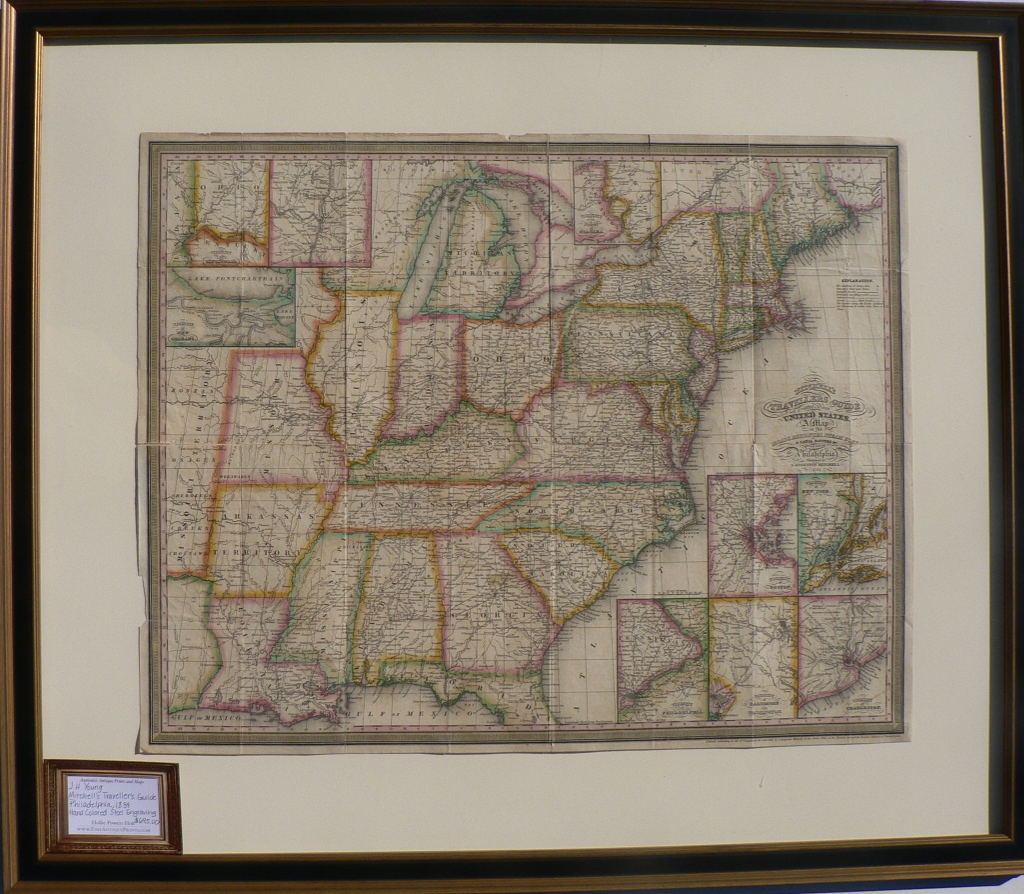
This beautiful map is titled Mitchell’s Travellers’ Guide through the United States, As the subtitle notes it is “A Map of the Roads, Distances, Steam Boat and Canal Routes by J.H. Young, Philadelphia. “ It also includes state capitals, principal cities and towns, turnpike roads, principal travelling roads and railroad lines. Inset maps show Boston, New York City, Baltimore and Washington, Philadelphia, Charleston, Albany, Cincinnati, New Orleans and the vicinity of the Falls of Niagara. The map depicts the country as it appeared during the presidency of Andrew Jackson with the Arkansas Territory, Missouri Territory, Michigan Territory and the territories of Indian tribes shown. An important map that was created in response to the building of roads and railroads and the migration of great numbers of Irish and German immigrants. It was issued as a folding pocket map that was intended to be carried and used so it is remarkable that it is in such excellent condition.
Hand colored steel engraving.
18 x 22 ½ inches, sheet.
Excellent condition with folds as issued.
Framed to museum specifications.
or click to inquire about this print.