
(The Roman Empire) Jean Baptiste Tardieu. Atlas Complete...Paris, 1812. $135.00
"Empire Romain"
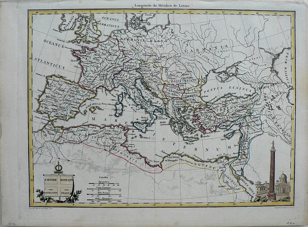
This beautifully engraved map shows the Roman Empire as it existed under Constantine and Trrajan. The title iis contained in a banner at the lower left. At lower right is an engraved view of a Roman town with an column topped by a sttue at the center.Jean Baptiste Pierre Tardieu (1746-1816) was a prominent French cartographer and engraver operating in the late 18th and early 19th centuries. Tardieu’s work is known for its beauty and accuracy as well as for its depth of detail. The maps are particularly highly valued for the decoration that surrounds the area of the title known as the cartouche. The prime meridian is shown to be Paris. Included in Conrad Malte-Brun’s Atlas Complete du Precis de la Geographie Universelle, published in Paris in 1812.
9 7/8 x 13 1/2 inches, sheet.
Engravings with modern hand color beautifully applied.
Excellent condition
or click to inquire about this print.