
(Japan) Robert de Vaugondy.Atlas Universel. Paris, 1757. $900.00
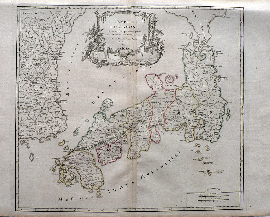
"L'Empire du Japon"
Robert de Vaugondy (1688-1766) also known as Le Sieur or Monsieur Robert to distinguish his work from that of his son Didier Robert de Vaugondy, was the preeminent French mapmaker in the 18th century. Thisantique map of Japan was included in his Atlas Universel, published in Paris in 1757, and one of the most important atlases of its time. Their maps represented a great step forward in terms of the detail shown and accuracy of the depiction. They combined information gleaned from earlier sources with that of recently completed surveys and verified and corrected latitude and longitude measurements and added many new places names. In recognition of this atlas’s tremendous contribution to cartography, Robert de Vaugondy was appointed geographer to King Louis XV in 1760.
This mid eighteenth century map of Japan show it deivided into 7 principal parts and 60 kingdoms.
De Vaugony maps are noted for the beauty of the ornamental engraving surrounding their title areas. In this case, beautiful flower arrangements, parasols and two views of Japanese landscapes with pagodas.
20 5/8 x 26 ½ inches, sheet.
Engraving hand colored outlining.
Very good condition save discoloration along centerfold.
or click to inquire about this print.