
(Plan of Tokyo) Tokyo, 1871. Wood block. $1,800.00
(19th century wood block map of Tokyo)
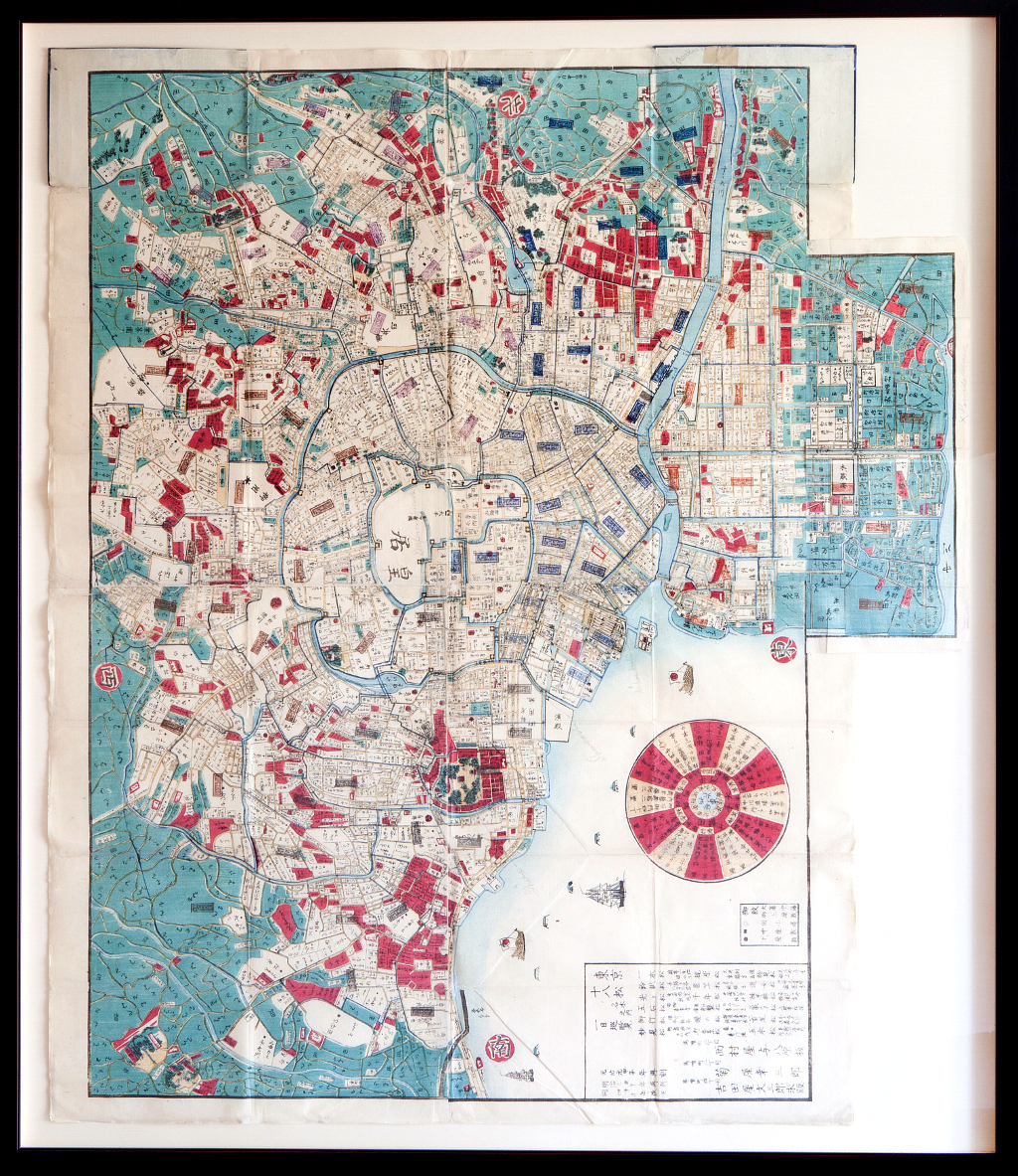
A fabulously decorative large scale plan of Tokyo with the imperial palace placed in the middle. The palace name is written in upside down characters in deference to the royal family.
The map shows the way to 18 revered pine trees located around Tokyo that can be visited in one day. It shows the name and address of the trees. Traditionally, conifers are very prized in Japan. It is interesting that there are also arboretums in the United States that have collections of Japanese pines. For instance, Haverford College, in Haverford, Pennsylvania has a Pinetum; a collection of 15 different varieties of pine trees including Japanese white pine (often used in bonsai), Japanese larch and Japanese umbrella trees.
The map's text reveals that the information it contained was so valuable that it was originally issued in 1864, reprinted in 1870 and updates were again made for this 1871 issue, published during the third year of the Meiji restoration. The original publisher, and owner of the wood block, was NISHIMURA-YA Yohachihara with the subsequent publishers KIKU-YA Bunsaburoo and YOSHIDA-YA.The words within the parcels of land indicate ownership. There are still some samurai family clan names on the map so an update may have been needed. The Meiji government was forfeiting samurai claims and some families moved away.
Please note that the map is oriented with North to the left.
Hand colored woodcut.
36 x 31 ½ inches, sheet.
With original cover.
Attractively framed to museum specifications with map archivally "floated" against fabric covered back mat and placed in a black cap molding with a red undercoat. Excellent condition.
or click to inquire about this print.