
(The canal from Coventry to Fradley Heath) London: Gentlemans Magazine, 1771. $150.00
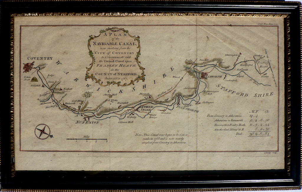
“A plan of the Navigable Canal, now making from the City of Coventry to Communicate with the Grand Canal upon Fradley Heath in the County of Strafford”
This map was published at a time when the section of the canal from Coventry to Atherstone had nearly been completed. As noted “This Canal was bugun to be Cut, or made in 1768 and is now nearly compleat from Coventry to Atherton.” When finished, it would include a stretch from Atherstone to Polesworht to Tamworh and Fradley Heath. The canal was used to transport goods including coal and cotton. The map includes major churches and towns along the route.
Framed.
9 ½ x 15 inches, overall.
Very good condition with two evident creases. Not examined out of frame.
or click to inquire about this print.