
Homann Heirs after Nicholas Bellin. (Eastern Canada) Paris, 1755. $500.00
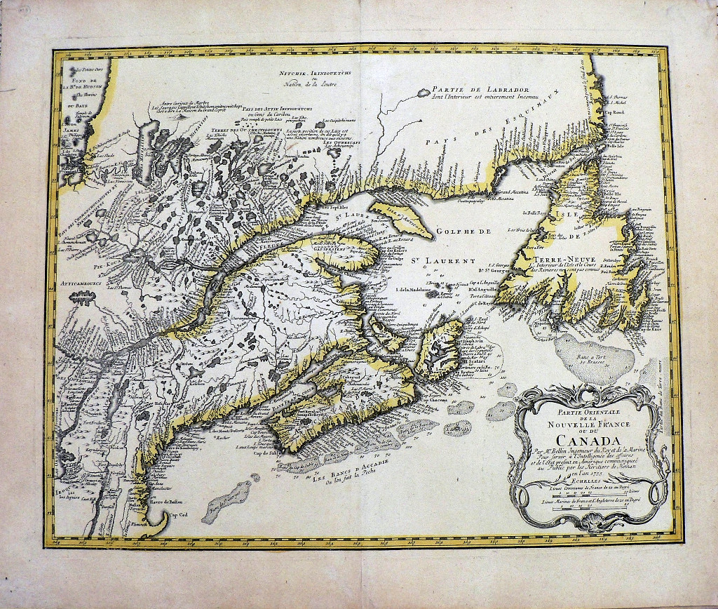
“Partie Orientale de la Nouvelle France ou du Canada”
This map describes the part of eastern Canada owned by the French in 1755 and a portion of northern New England. The areas shown include Newfoundland, Labrador, New Brunswick, the course of the St. Lawrence, including Quebec and Montreal and extends to Lake Ontario and Lake Champlain. French text spread across the map informs the reader of the cartographer’s uncertainty of the exact location of Indian territories and their languages as well as such charming observations as “dont l’Interieur est entierement Inconnu” (the interior is entirely unknown. Details include bodies of water, rivers, mountain ranges, soundings and shoals. The map includes “Les Bancs D’Accadie” now known as Georges Bank, an elevated area of the sea floor crucial to the fishing industry. Cape Cod is located on the lower left hand corner of the map.
Based upon the vitally important maps created by Charlevoix in the early 18th century but with additional information including Bellin’s charts of the waters useful to both the French and British during the French and Indian Wars fought 1756-63.
Engraving with outline coloring.
25 x 21 inches, sheet.
Excellent condition.
or click to inquire about this print.