
(West Indies) Johnson's New Illustrated Family Atlas. New York 1864. $395.00
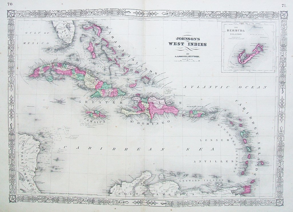
“Johnson’s West Indies”
Inset: The Bermuda islands
Large detailed map of the Caribbean Sea and its island nations published by Alvin J. Johnson for his New Illustrated Family Atlas of the World with Physical Geography and with Descriptions Geographical, Statistical and Historic…, from plates he purchased from J. H. Colton. This map is typical of those Johnson produced between 1863-69 with its identifying fretwork border design.
Hand-colored lithograph, 28 ½ x 18 inches sheet size. Very good condition.
or click to inquire about this print.