
(Poland) "Silesia.." Jansson, Jan. after Pitt. Amsterdam, ca. 1680. $825.00
"Silesia Ducatus..."
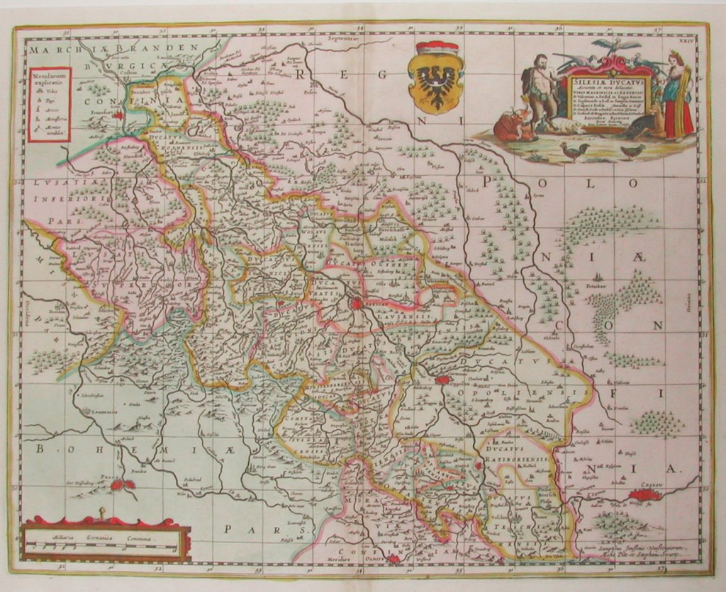
This beautiful and highly detailed map by Jansson after Moses Pitt is in excellent condition with the original vibrant coloring perfectly preserved. It depicts a region in east central Europe that consists mostly of southwest Poland with parts of the Czech Republic and eastern Germany. In this engraving, the region to the northeast is colored light pink and described as "Regni Poloniae" with city of "Crackaw" clearly marked on the lower right. The region to the southwest is colored in green and identified as "Bohemia Pars.:" with "Praga" shown as the most populous settlement there. Silesia is the area between the two. "Francfurt" on the Oder is shown at the upper left of the map, Breslau is in the center with "Olmitz", and current day Olomouc, Czechoslavia at the center bottom.
Silesia in the valley of the Upper Oder has a fascinating and a complex history. For centuries it was a part of Poland and at one time divided into many principalities, it passed to Bohemia in the 14th century, to the Holy Roman Empire in 1478, was the scene of much warfare in The Thirty Years War, was seized by Prussia from Austria in 1742, assigned to Poland in 1921 and invaded by the USSR in WW II. At the Potsdam Conference, the greater part became Poland with several small districts assigned to East Germany. (See Websters Geographical Dictionary.)
20 x 23 inches, sheet.
Hand colored copperplate engraving.
Excellent condition with original color and full margins.
or click to inquire about this print.