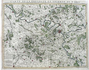
(Paris and Surrounding Area) Guillaume Delisle. Amsterdam: Covens and Mortier, c. 1735. $525.00

”Carte de La Prevoste et Vicomte de Paris”
We are pleased to offer for sale this beautiful original antique map of Paris and the surrounding area of France. It will appeal to anyone who loves France, Paris, and gorgeous early maps. The map was designed by the preeminent French mapmaker of the early 18th century. As in all maps produced by Delisle, it clearly presents many details concerning the locations of chateaux, forests, towns and churches. The size of the settlements is indicated with Paris, Vernon, Mante, Meulan, Meaux, Poissy, Pontoise, Beaumont, Lasarche, Dammartin, Meaux, S. Denis, Corbeil, Chartres, Doudan, Rochefort, Epernon, Estampes, Gaillardeon, Ablis, Nogent le Roy, Dreux, Houdon, and Pacy among the largest. The map depicts the area surrounding Paris south to Chartres, Estampes, Fountaineblean and Melun, North to Vernon and east to Meaux. Interestingly, Montmartre is shown well outside the city limits at the time.
21 x 26 1/2 inches, sheet.
Copper plate engraving with full original coloring.
Finest possible condition.
or click to inquire about this print.
