
Hondius, Henricus. (Holy Land) Amsterdam, 1630. $725.00
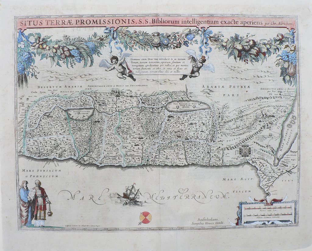
“Situs Terrae Promissionis S.S. Bibliorum intelligentiam exact aperiens per Chr. Adrichom”
This is an early edition of Hondius’ map of the Holy Land based upon the report of Christian Van Andrichom, the most influential mapmaker of the area of the time. The map is oriented with north to the left. The area depicted extends between the Nile Delta to Sidon.
The map has an enormous amount of ornamental detail with an elaborate garland of fruit - grapes, pomegranates, apples,etc. - and flowers including lilies, roses and tulips fully occupying the area below the title. Old Testament Biblical references include the location of the 12 tribes, the encampment of the Israelites during the Exodus, Moses receiving the Ten Commandments flanked by Aaron, a reference to Jonah and the whale in the Mediterranean Sea, and minute detail of topographical information, buildings and place names.
17 ¼ x 21 ½ inches, sheet.
Hand colored copper engraving.
Good condition. Professionally conserved.
or click to inquire about this print.