
(Southern Spain...) Mathias Seutter. Augsberg, ca. 1740. $495.00
"Accurata...Andalusiae, Castellum, Gilbrator inter in Europam et Africam..."
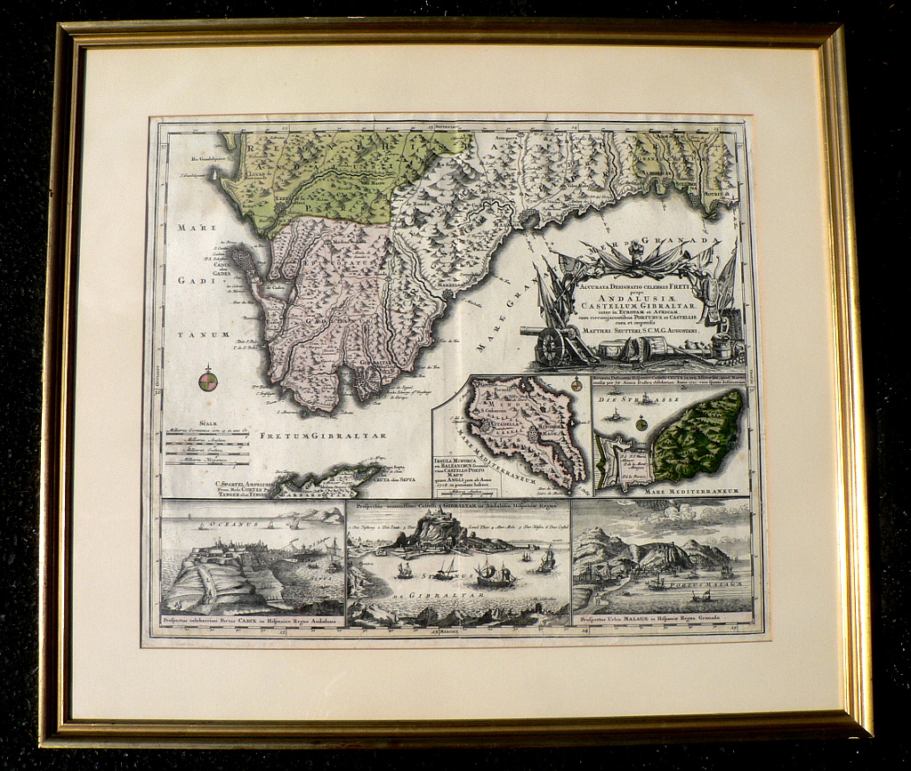
This superb original eighteenth century map of the southern coast of Spain focuses on the important fortifications protecting the entrance to the Mediterranean Sea. The map covers the region extending from the mouth of the Rio Guadalquivir in the west to Motril in the east. It includes schematic representations of the relative sizes of the larger towns and the direction of their settlement. The maps includes insets of the Spanish fortress of Ceuta on the Moroccan Peninsula de Almina, two small inset maps of Minorca and Ceuta, and three views featuring Cadiz, the Gibraltar fortress, the port of Malaga. The title is surrounded by elaborate engraving of military items including a canon.
Hand colored engraving.
Crisp strong impression and original color.
Framed to 27 ½ x 30 ¾ inches,
or click to inquire about this print.