
The World... Philadelphia: S. Augustus Mitchell, 1852. $135.00
"The World..."
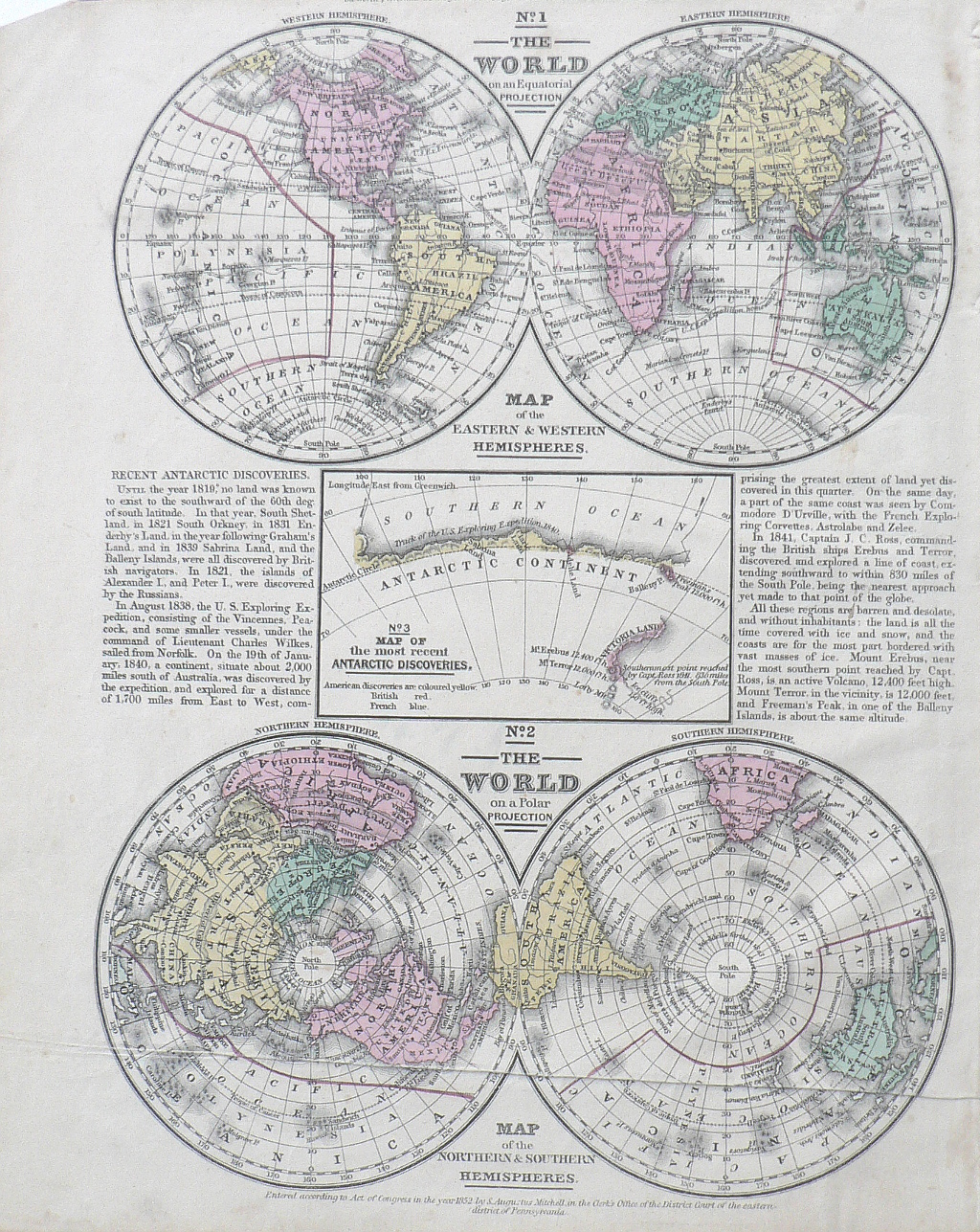
An affordable mid 19th century world map in two views, one showing the eastern and western hemispheres on an equatorial projection and a map of the Northern and Souther hemispheres on a polar projection. In the 30 years preceding the publication of this map, discoveries in the Antarctic were big receiving great attention in the scientific and the popular press. The text on this map notes that "until the year 1819, no land was known to exist to the southward of the 60th degree of south latitude." The text also records the Russian discoveries that followed as well as the 1838 expedition by Charles Wilkes and his crew aboard the Vincennes and Peacock that discovered the continent 2,000 miles south of Australia and subsequent disoveries by the British and French. An inset shows the most "Recent Discoveries" by the Americans, British and French. The courses of the expeditions are indicated on the maps.
11 1/2 x 9 1/2 inches.
Hand colored lithograph.
Very good condition save crease at bottom.
or click to inquire about this print.