
(East Brandywine Township) Breous Farm Atlas. Philadelphia 1883. $195.00
"East Brandywine Township"
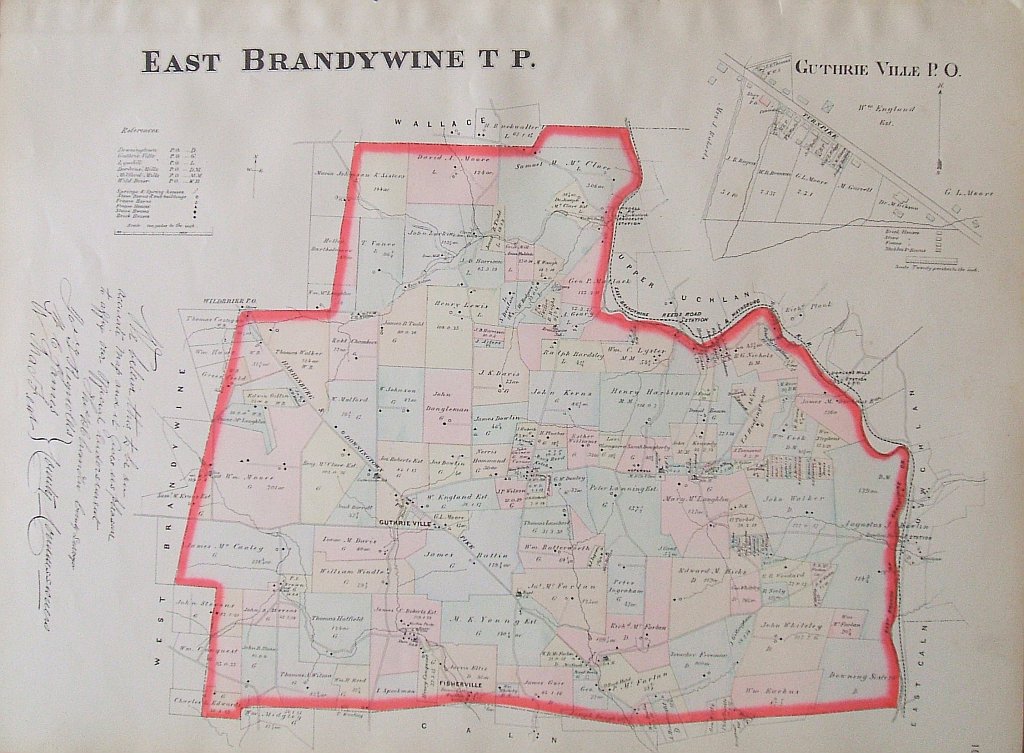
Original hand colored lithographed plate from, Breous's Official Series of Farm Maps Chester County, Pennsylvania, Compiled, Drawn and Published From Personal Examinations and Surveys, published by W.H. Kirk & Co., Philadelphia 1883. The maps from this early atlas are full of interesting historical detail of Chester County, Pennsylvania.
Lithograph , hand colored.
20 1/2 x 28 1/2 inches sheet.
Very good condition.
or click to inquire about this print.