
(West Chester) A. H. Mueller. Pl. 22. Atlas...from ...Devon to Downingtown and West Chester. Philadelphia, 1912. $295.00
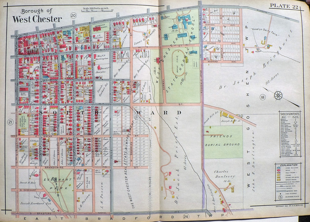
"Borough of West Chester"
We have a large selection of large scale maps of properties (residential, commercial, and institutional) that extended along the tracks of the Pennsylvania Railroad between Devon to Downingtown. The maps contain fascinating information about property owners, types of buildings on the properties with frame, brick, barns, stables, green houses all shown, sewer lines, steam railways, electric railroads and “macadamized” roads. This map was included in a particularly beautifully colored atlas.
This map is exceptionally handsome. Details include the 77 plots of the West Chester Real Estate & Improvement Company, the plots of the Roselyn subdivision, the children's play ground, Everhart Park, the grammar school on High Street at Dean, the State Normal School and the Friends Burial Grounds.
22 x 31 ½ inches, overall.
Hand colored lithograph.
Excellent condition
or click to inquire about this print.