
(West Vincent) Plate 3. Philadelphia: Franklin Surveys, 1934. $225.00
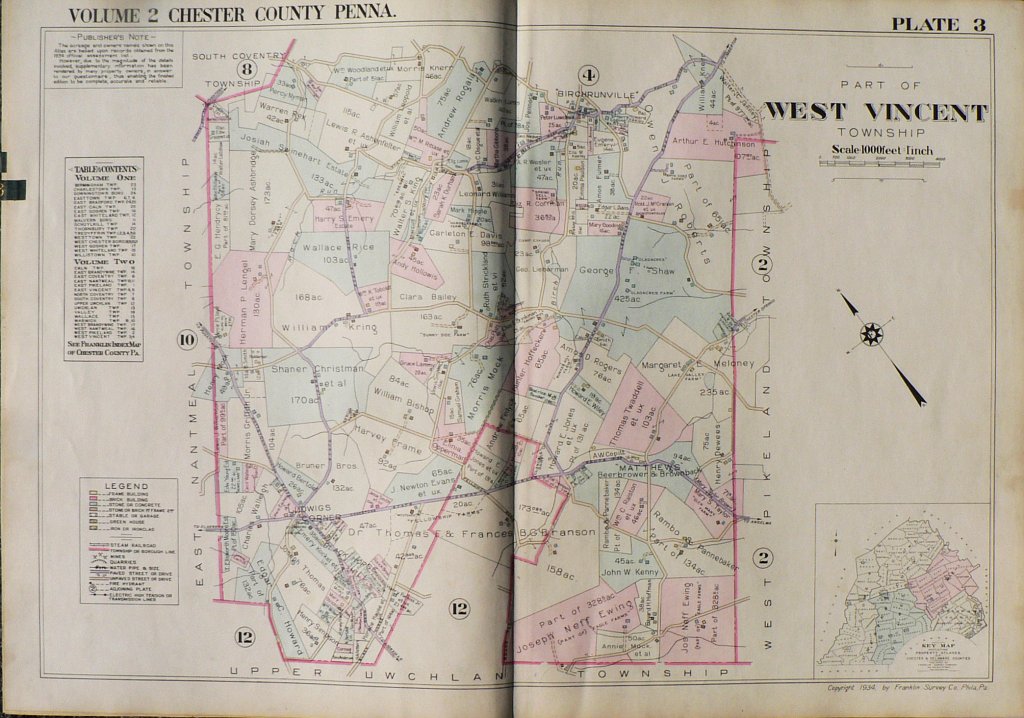
"Township of West Vincent" Chester County, PA.
A detailed, colored and keyed 1934 property atlas compiled by the Franklin survey Company in 1934. The maps included owner's names, types of contruction - frame, brick, stone, stucco, iron or iron clad - garages and stables as well as the location of mines, quarries, steam railroad lines and paved, unpaved and private roads.
The towns of Birchrunville and Ludwig Corners are shown on this map.
Other maps in the atlas include East Pikeland, West Pikeland, West Vincent, East Vincent, East Coventry, North Coventry, South Coventry, Warwick, East Nantmeal, Upper Uwchlan, Uwchlan, East Brandywine, Wallace, West Nantmeal, West Brandywin, Caln. Please contact us to request photographs of these maps.
23 1/2 x 33 inches, sheet.
Excellent original condition. Backed by linen as issued.
or click to inquire about this print.