
Upper Providence. Historical Atlas...Philadelphia: Scott, 1877. $200.00
 "Upper Providence"
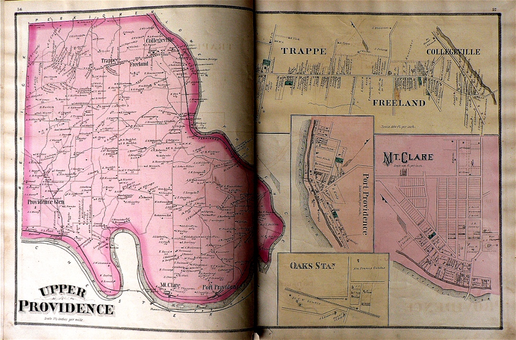
A doublepage map from a beautifully hand colored series of map which were as stated on the titlepage “Compiled, Drawn and Published from Personal Examinations and Surveys” in the year following the opening of Philadelphia’s Centennial celebration. Engraved by C.F. Ruff, Walnut Street, Philadelphia for the Historical Atlas of Montgomery County, Pennsylvania Illustrated. This map includes detailed insets of Trappe, Freeland, Collegeville, Port Providence, Mt. Clare and Oaks Station.
27 x 13 ½ inches.
Lithograph with beautifully preserved original hand coloring.
Excellent condition save minor tear to margin at center bottom.
Note: The condition and color of the map is superior to what it appears to be in the photographs. If it interests you we invite you to ask to receive additional photos
or click to inquire about this print.