
(Center City at City Hall) Philadelphia: Elvino Smith, 1927. $225.00
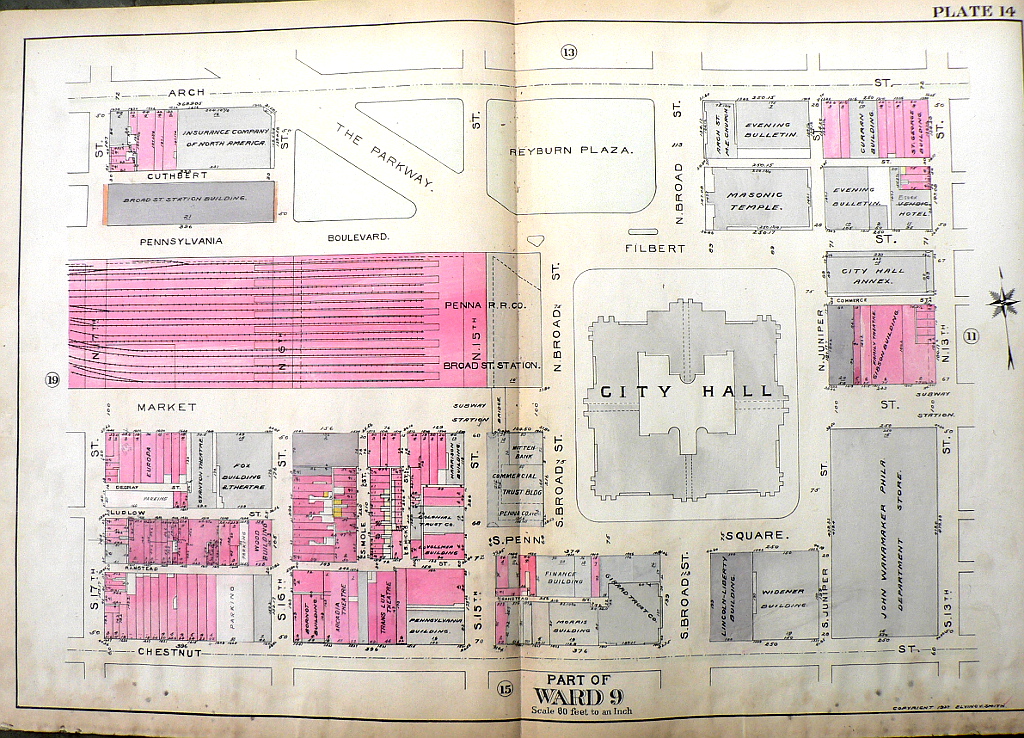
Plate 14. Part of Ward 9.
A very large scale map (80 feet to the inch) of the area in Center City Philadelphia surrounding City Hall and the Pennsylvania Railroad Company's Broad Street Station, bounded by Arch on the north, 17th Street on the west, Chestnut Street on the south, and 13th Street on the east, and including the City Hall Annex, the John Wanamaker store (now Macy's), the Masonic Temple and Evening Bulletin buiildings, the Insurance Company of North America as well as the buildings associated with many other commercial enterprises.
Hand colored lithograph.
21 1/2 x 32 inches, sheet.
Good condition save evidence of exposure to water in bottom margin.
or click to inquire about this print.