
(Radnor) A. H. Mueller. Pl. 24 Atlas from ... Overbrook to Paoli... Philadelphia, 1913. $295.00
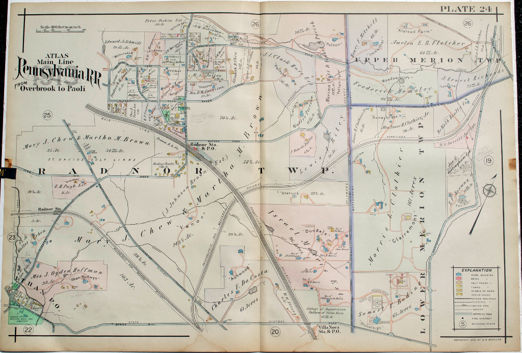
Pl. 24 Radnor Township with portions of Lower and Upper Merion Townships, Claremont and J.J. Brown estates.
We have a large selection of large scale maps of properties (residential, commercial, and institutional) that extended along the tracks of the Pennsylvania Railroad between City Line at Overbrook and Paoli to the west. The maps contain fascinating information about property owners, types of buildings on the properties with frame, brick, barns, stables, green houses all shown, sewer lines, steam railways, electric railroads and “macadamized” roads. This map was included in a particularly beautifully colored atlas.
Shows Radnor Station, Ithan Post Office, Belrose and Hillside Farm
22 x 31 ½ inches, overall.
Hand colored lithograph.
Excellent condition save 2 light water stains in extreme lower margin
or click to inquire about this print.