
(Wayne and St. Davids) A.H. Mueller. Pl. 22. Atlas from ...Overbrook to Paoli. Philadelphia, 1908. $500.00
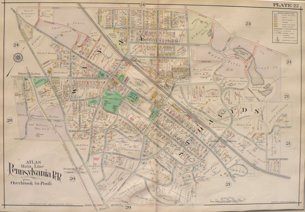
Plate 22
A beautiful impression of the hard-to-find map of South Wayne and St. Davids that includes enormous detail of properties, schools, churches, Louella Mansion, train stations, etc. The map extends from Eagle Road to Five Points. It shows the Pennsylvania Railroad line and its Wayne and St. Davi’s stations as well as the Philadelphia and Western Railroad line and its Wayne station. The current Middle School is identified as “Radnor School District.” Louella Mansion, St. Mary’s and Baptist church sites are also shown.
22 x 31 1/2 inches, overall.
Hand colored lithograph.
Excellent condition.
or click to inquire about this print.