
(Valley Forge) A.H. Mueller. …Atlas Main Line Pennsylvania RR from Devon to Downingtown, 1912. $325.00
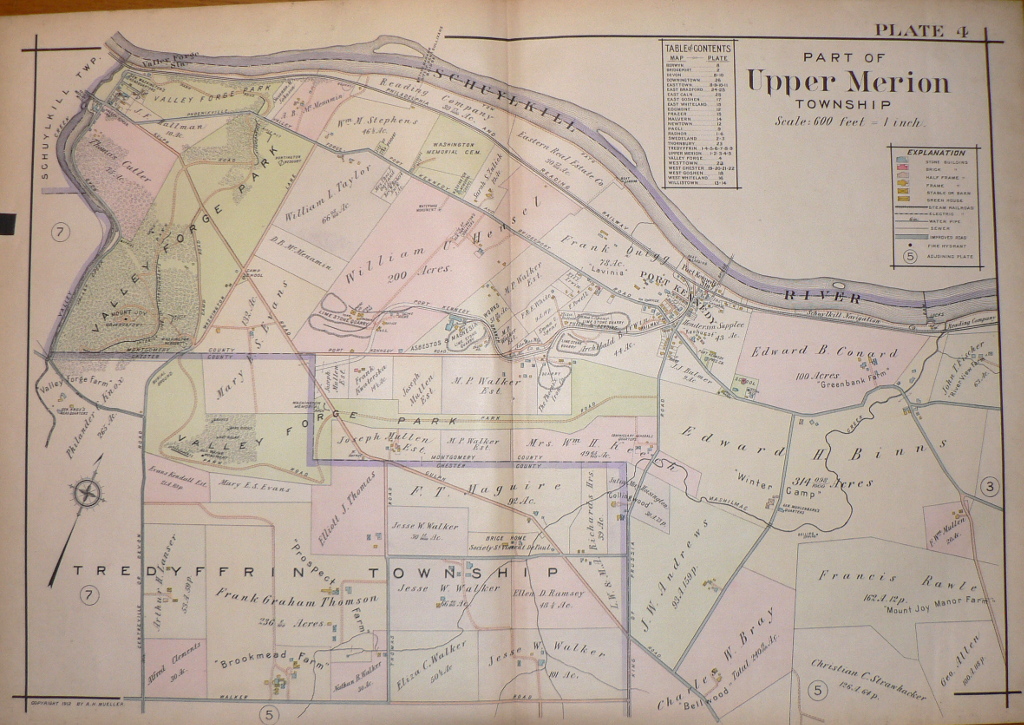
“Part of Upper Merion”
Bounded on the west by Valley Creek and Valley Creek Road and on the North by the Schuylkill River. This map shows Valley Forge Park, the Valley Forge Park Observatory, Washington’s headquarters, entrenchments, Mount Joy, burial grounds, Washington Memorial Chapel, Washington Memorial Arch within the Park and Valley Forge Farm, the Commissary General’s quarters, General Muhlenberg’s quarters and property owners outside the Park limits. It shows Port Kennedy an industrial center named after Alexander Kennedy who purchased the land from Mordecai Moore to quarry the limestone and lime deposits found there in the late 18th century. The Henderson Supplee Mansion remains on that site.
22 x 32 inches, sheet.
Hand colored lithograph.
Excellent condition.
or click to inquire about this print.