
(Wayne, St. Davids) A.H. Mueller. Pl. 23 Atlas from ... Overbrook to Paoli...Philadelphia, 1913. $295.00
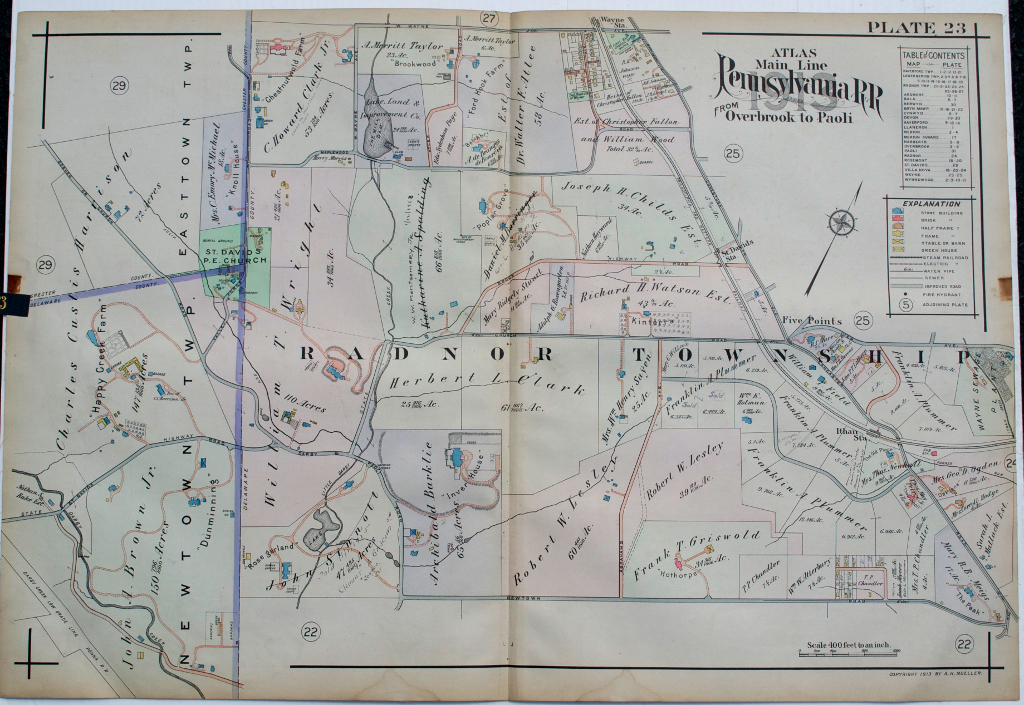
Pl. 23 Radnor Township, Newtown and Easttown. Clark and Wright estates, St. David's Church
We have a large selection of large scale maps of properties (residential, commercial, and institutional) that extended along the tracks of the Pennsylvania Railroad between City Line at Overbrook and Paoli to the west. The maps contain fascinating information about property owners, types of buildings on the properties with frame, brick, barns, stables, green houses all shown, sewer lines, steam railways, electric railroads and “macadamized” roads. This map was included in a particularly beautifully colored atlas.
Includes the land that became Chanticleer and the developments Of Ravenscliff, Roundhill, Inverary and Brooke Farm.
22 x 31 ½ inches, overall.
Hand colored lithograph.
Excellent.
or click to inquire about this print.