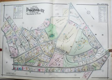
Antique Railroad Maps of the Philadelphia Area. 1860-1930. $295.00

An antique map, like this one of Ardmore, of your friends', family members', employer's or employees' property makes a unique and cherished gift
The area where their house now sits, may be depicted on one of our many large-scale atlas maps of Philadelphia and the Philadelphia suburbs. These large maps, most are approximately 22 x 31 inches, were included in colored atlases published for the railroads between 1860 and 1930. They contain fascinating detail concerning property ownership as well as private and public buildings. And, if the house was built before the time of the publication of the map, the structure itself may be shown on the map!
Contact us with the address you would like to find. We will check our inventory and get back to you. Prices range from $175 to $350.
Pictured below is a detail of a map of a portion of Merion and Bala Cynwyd. This particular map is $175. It is one of dozens in our collection.
or click to inquire about this print.
