
Manhattan and Brooklyn. New York: 1895. $195.00
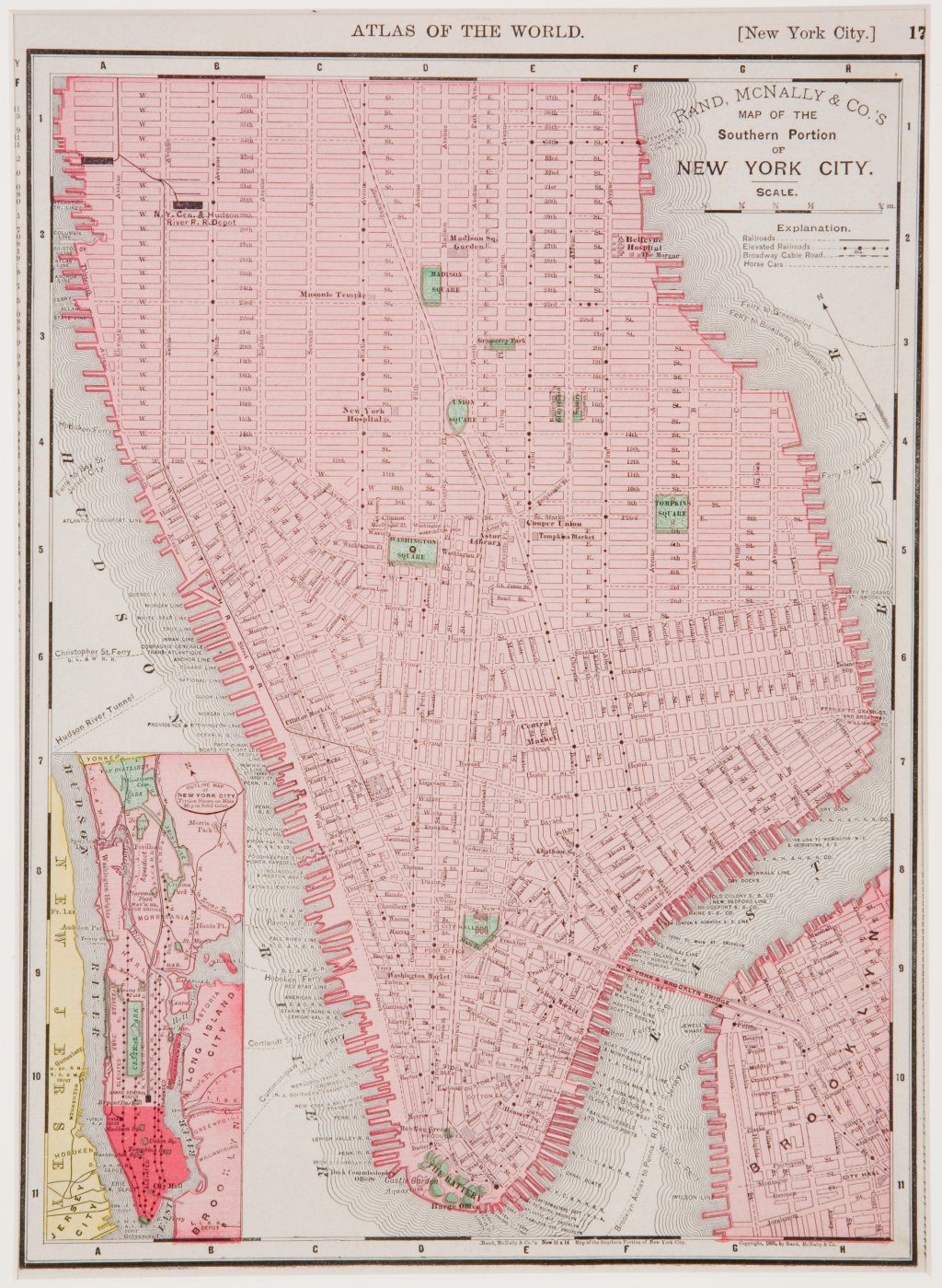
Doublesided map of Brooklyn and the Southern Portion of New York City.
New York: Rand McNally, 1895.
A wonderfully detailed and easy to read map of the southern portion of Manhattan Island including roads,fridges, railroad lines, "Broadway Cable Road" and "Horse Cars." Inset views show Lower Manhattan and Brooklyn in their geographical context.
Colored lithograph.
14 1/2 x 10 1/2 inches, sheet.
Map is matted so that both sides show. It could be framed in the same manner.
See our Maps category for plans of cities and countries around the world.
or click to inquire about this print.