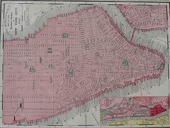
(New York City/Brooklyn) Chicago: Rand McNally, 1895. $175.00

"Map of the Southern Portion of New York City" and "The Main Portion of Brooklyn"
A highly detailed and very legible double sided map showing on one side the lower portion of Manhattan south from 37th Street, including a portion of Brooklyn and an inset of all of New York City showing the eastern portion of New Jersey along the Hudson and Long Island City along the East River and on the other side a horizontaly oriented view of Brooklyn from the East River to Prospect Park . We have matted the sheet so that it can be viewed from both sides. It could be framed to show the same view.
11 1/4 x 14 inches, sheet.
Lithograph.
Excellent condition.
or click to inquire about this print.
