
S.A. Mitchell. Massachusetts and Rhode Island. Philadelphia, 1946. $250.00
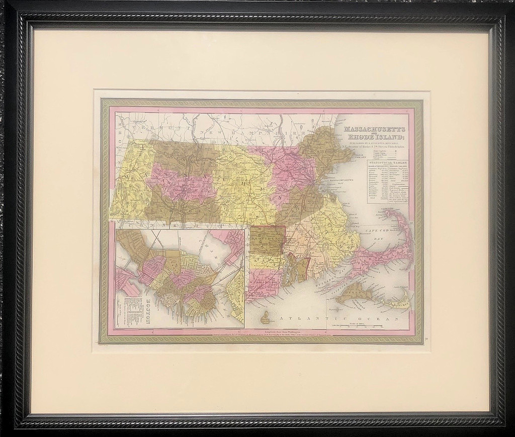
Massachusetts and Rhode Island.
An attractive easily legible map including the locations of canals, railroads and proposed works. A table provides the population of the counties of Suffolk, Essex, Middlesex, Plymouth, Norfolk, Bristol, Barnstable, Nantucket, Dukes, Worcester, Hampshire, Hampden, Franklin and Berkshire in Massachusetts and Providence, Newport, Washington, Kent and Bristol counties in Rhode Island. Detailed inset of Boston in lower right. Good detail of the Cape, Martha’s Vineyard and Nantucket Island.
Hand colored lithograph.
Approximately 13 x 16 inches sheet.
Framed to museum specifications with ultraviolet filtering Plexiglas to 20 5/8 x 24 inches, overall.
or click to inquire about this print.