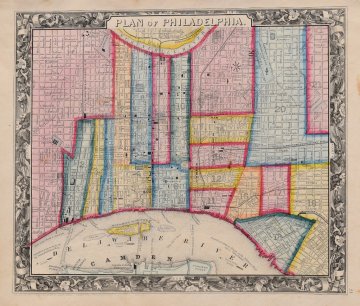
S. Augustus Mitchell. (Philadelphia). New General Atlas. Philadelphia 1860. $295.00

"Plan of Philadelphia"
A detailed and beautifully hand colored original antique lithographed map of the State of Pennsylvania with topographical detail and place names clearly legible. The map was included in Samuel Augustus Mitchell’s, New General Atlas, Containing Maps Of The Various Countries Of The World, Plans Of Cities, Etc. Embraced In Forty-Seven Quarto Maps, Forming A Series Of Seventy-Six Maps And Plans, Together With Valuable Statistical Tables. The whole is surrounded by Mitchell’s signature decorative border. The map depicts the whole of Philadelphia divided into 21 districts or wards. The remarkable detail on this map extends down to the street level including landmark buildings, churches, and hotels. Also indicates ferries between Camden and Philadelphia and Steamboat routes on the Delaware River.
Lithograph, with full, brilliant original hand color.
12.5 x 15.5 inches, sheet.
Excellent condition.
or click to inquire about this print.
