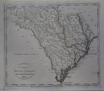
(South Carolina) John Scoles. New York: I. Low, 1799. $495.00

"The State of South Carolina from the best authorities 1799"
Wonderful early map of South Carolina by John Scoles (1772?-1853 - cartographer) and included in, The New and complete American Encyclopedia, or, Universal dictionary of arts and sciences. The map covers roughly the territory of modern day South Carolina, running along the Atlantic coast from Long Bay to the Savannah Sound, and then inland with the Savannah and Tugeloo River's forming the southern boundary of the state. There is an error in scale contributing to the state appearing about 15% larger than actuality. A fine period map of South Carolina offering considerable detail naming the eight precincts of the state as well as municipal boundaries, cities, towns, roads, and topographical notes.There is a high probability that this is the same map that appeared in "A new and complete system of universal geography : describing Asia, Africa, Europe and America, with their subdivisions of republics, states, ..." by John Payne, although that title or attribution appears nowhere on this map.
Uncolored copperplate engraving on laid paper.
8 x 10 inches sheet.
Excellent condition.
or click to inquire about this print.
