
Texas and Indian Territory Map, published Philadelphia 1876. Framed. Sold
“Gray’s New map of Texas and the Indian Territories”
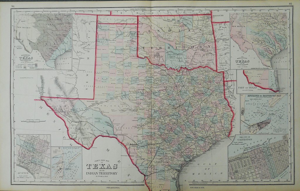
This detailed state map of Texas was published in 1876 in Gray’s Atlas of the United States with General Maps of the World. Accompanied by Descriptions Geographical Historical Scientific and Statistical, six years after Texas was re-admitted to the Union. It shows a state neatly divided into counties with criss-crossing railroad lines. With insets of Austin, Galveston, and Galveston Harbor the map shows the Indian Territory – the area where the Five Civilized Tribes were sent after being removed from southeastern US. By 1890, more than 30 Native American nations and tribes had been concentrated on land within “Indian Country." Hand colored lithograph measuring 17 ½ x 28 inches sheet size. Excellent condition