
John Lodge after Thomas Jeffreys. ...North America... London, 1778. $395.00
“A General Map of North America from the Latest Observations” London, The North American Gazzateer, 1778.
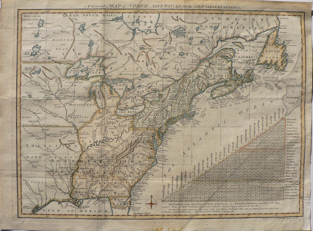
The area shown by this map extends from the Gulf of Mexico in the south to New South Wales and Labrador in the north, westward to what is now Alabama in the south and the Lake of the Woods in the northwest. The focus is the British holdings in the American colonies at the outbreak of the American Revolution but it also shows historical boundaries as far back as the “bounds of Virginia and New England” in 1609 and the New World territorial impact of the 1713 Treaty of Utrecht. The map includes a great deal of information concerning the frontier wilderness including forts, Indian villages and territories. Mythical islands in Lake Superior are information retained from earlier French maps. Earl Granville’s land is shown to extend far west of the Mississippi. The scale in the lower right quadrant shows the Distances of the “most noted Towns, Forts, etc. in North America.”
11 x 15 inches. Sheet.
Engraving with hand color.
Folds as issue. Flattened creases in lower right. Over all very good condition.
or click to inquire about this print.