
after Lewis Evans. (Middle Dominions of the colonies) London: Laurie and Whittle, 1794, SOLD
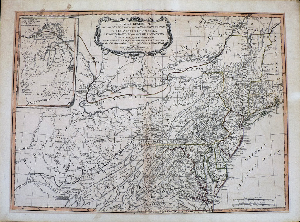
“A New and General Map of the Middle Dominions Belonging to the United States of America, viz Virginia, Maryland and Delaware Counties, Pennsylvania, New Jersey &c. With the Additions of New York, & of the Greatest Part of New England &c as also of the Bordering Parts of the British Possessions in Canada””
The earliest appearance of this influential map by Lewis Evans was when it was published in 1750. Considered to be one of the most important 18th century maps of the British Colonies, it was sent to the London Board of Trade in 1751 for their use and was consulted by General Braddock during the French and Indian War. The 1750 map was one of the earliest to show oil in Pennsylvania, the first to show coal in Ohio and the first to accurately map the trans-Appalachian and Ohio River Region.
The area shown extends along the east coast from east of Dartmouth College (identified along the Connecticut River in New Hampshire) south to Norfolk, Virginia and on the west, to Lake Huron in the north and south to the confluence of the Ohio River and the Wabash in Kentucky. An inset in the upper right is entitled “A Sketch of the Upper Parts to show the Remainder of the Lakes.” The map contains a plethora of fascinating detail and textual observations concerning Indian territories, “Elephant bones found here” in the Ohio River Valley, suggestions of passable ways through mountains and where ways through could not be found, and where good uncultivated land existed.
21 ¼ x 28 ¾ inches, sheet.
Engraving with original outline coloring.
Excellent condition save light burn mark surrounding neat line.
Light overall patina