
(British Isles) Robert De Vaugondy. Paris, 1747. $595.00
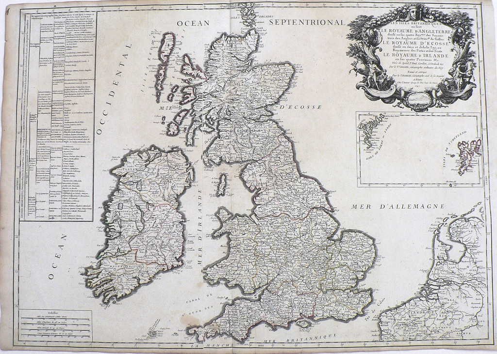
The map handsomely details the British Isles described as Le Royaume D’Angleterre (England), Le Royaume D’Ecosse (Scotland), and Le Royaume D’Irlande (Ireland). It includes small islands off the south west coast of England, the Isle of Man, the “Etudes Westernes” or the Hebrides, the Aran Islands and the Isle of Skye and boundaries, city names, mountain ranges, and major bodies of inland water. A map legend located on the left side, written in French provides information concerning the history of the governance and religion of areas. An elegantly engraved cartouche surrounding the title area, includes men, horses, sheep and fish. An inset shows “Isles de Farre ou Ferro” and “Isles de S Chetland.”
A wonderful map for anyone with English, Scottish or Welsh ancestry studying their family's mid 18th century genealogy.
Engraving with hand colored outlining.
28 3/8 x 30 ¾ inches, sheet.
A nice crisp impression in very good condition save small light stain at bottom center
or click to inquire about this print.