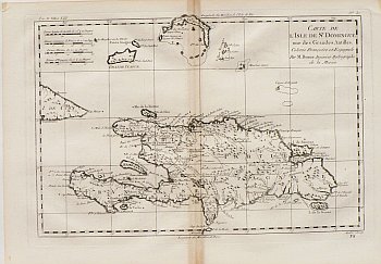
(Haiti and the Domincan Republic) Bonne, Rigobert. Paris, c. 1760. $350.00
 Bonne, Rigobert
 “Carte de L’Isle de St. Dominigue une des Grandes Antilles”
The island is the focus of this crisply engraved and detailed map with the “Partie Francoise” (Haiti) and the “Partie Francoise” (now the Dominican Republic) clearly shown as well as rivers, good anchorages, topographical information and observations, copper mines, settlements, locations of churches, etc. The detailed depiction extends to Cap Maisy and the eastern most portion of Cuba, the Turks and Caicos, Great and Little Inagua Island, Silver Bank and adjacent “Mouchoir Carre.”
10 x 14 ½ inches, sheet.
Copper engraving.
Very nice condition save minor discoloration along centerfold.
or click to inquire about this print.
