
(The Netherlands and part of France) Jean Baptiste Tardieu. Atlas Complete. Paris, 1812. $125.00
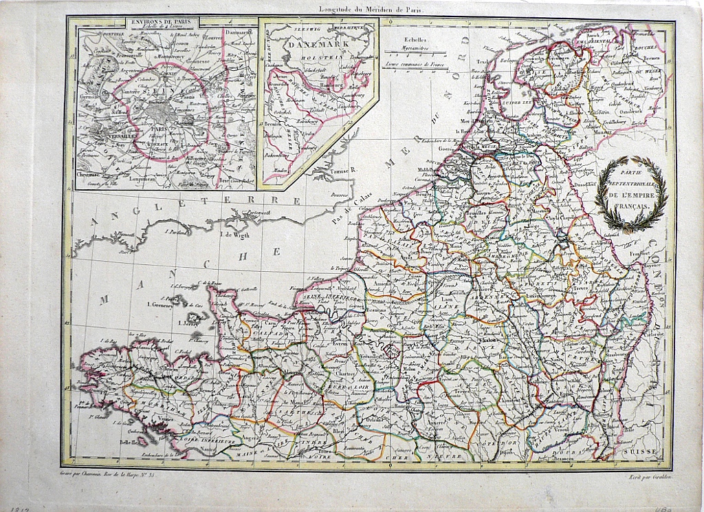 "Partie Septentrionale de L'Empire Francais"
Jean Baptiste Pierre Tardieu (1746-1816) was a prominent French cartographer and engraver operating in the late 18th and early 19th centuries. Tardieu’s work is known for its beauty and accuracy as well as for its depth of detail. The maps are particularly highly valued for the decoration that surrounds the area of the title known as the cartouche. The prime meridian is shown to be Paris. This map was included in Conrad Malte-Brun’s Atlas Complete du Precis de la Geographie Universelle, published in Paris in 1812. This detailed map of the southern portion of the French empire in 1812 shows the northern part of France and The Netherlands with an inset of the area around Paris and one of Denmark.
13 1/2 x 9 7/8 inches, sheet.
Engraving with modern hand color beautifully applied.
The sheet has a lovely light patina not evident in the photo.
Excellent condition
or click to inquire about this print.