
(Aquitaine) Johann Baptiste Homann. Nurenberg, ca. 1730 $595.00
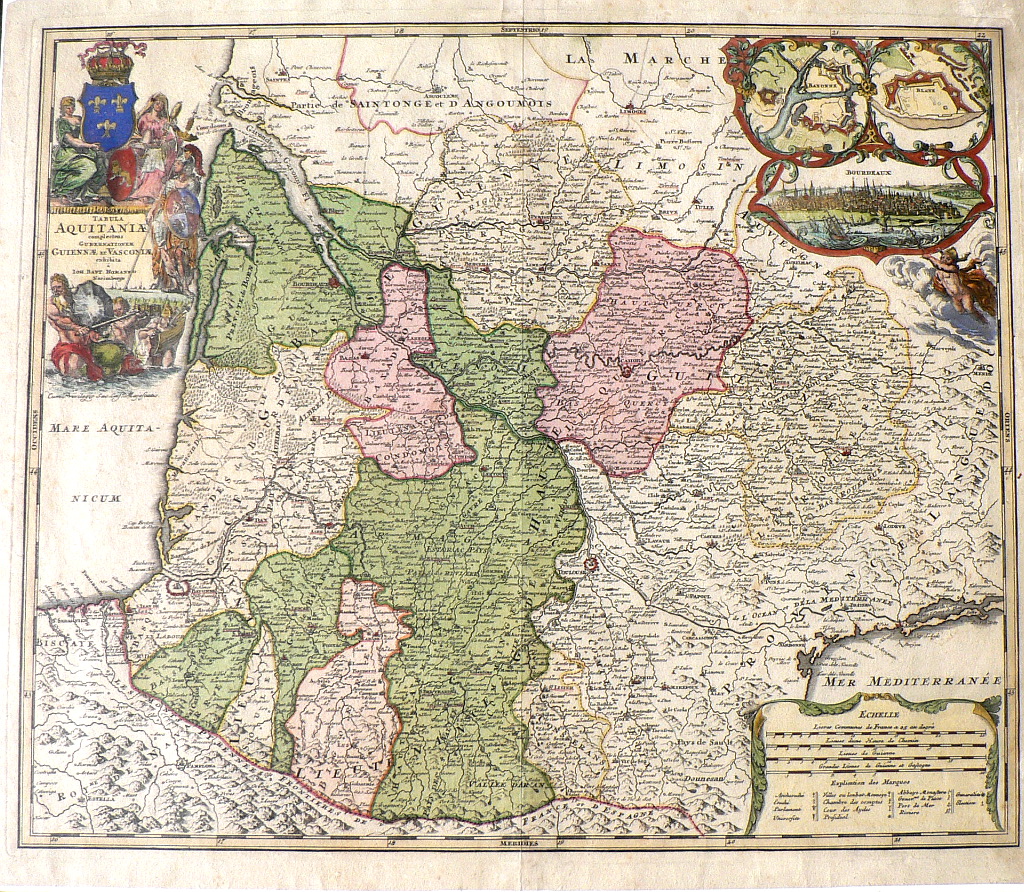
“Tabula Aquitaniae complectens Gubernationem Guiennae, et Vasconiae..
An original antique map by Johann Baptist Homann published Nurenburg Circa 1730. Shows the duchy of Aquitaine in the southwestern corner of France bounded by the Pyrenees and the Atlantic Ocean. It is composed of the 5 departments of Dordogne, Lot and Garoone, Pyrenees-Atlantiques, Landes and Gironde. The map has a decorative title area with mermen and a knight on horseback. The upper right of the map contains vignette plans of the towns of Bayonne and Blaye and a beautiful bird’s-eye view of Bordeaux.
Engraving with beautifully preserved original hand coloring.
20 ½ x 24 ¼ inches.
Excellent condition save some evidence of handling in the margins.
or click to inquire about this print.