
Jan Jansson. (Lorraine province France) Amsterdam 1639. $395.00
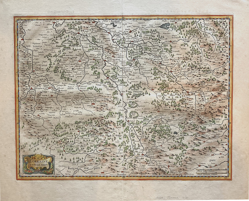
“Lorraine vers le Midy”
For one hundred years, beginning in the last quarter of the 16th century, Dutch mapmakers were in the forefront of cartography. Their maps contained the most up-to-date geographical information and were usually elaborately engraved with illustrations surrounding the title area, the scale of miles or elsewhere on the sheet. The Blaeu, Jansson, De Witt and Visscher families were the three most powerful dynasties of mapmakers during this period.
This map was created by Jan Jansson (also known as Johann or Jan Janssonius or Janszoon) (1588-1664) a renowned geographer and publisher of the seventeenth century. His eleven volume work was printed in 1639 with later editions up to 1660, at which point the atlas bore the appropriate name Atlas Major. The map is decorative focused on the center of the Lorraine. The map provides an enormous amount of place names, small villages and towns, as well as rivers, lakes, woods and mountains are named. Much of Lorraine is forested and hilly and this is described with charmingly engraved trees. The Vosges Mountains rise along the region’s historical border of Alsace on the east. Main rivers are labeled. At the bottom a small mileage scale and a small title cartouche.
Copperplate engraving with full original hand color.
19 x 22 1.2 inches sheet. Full untrimmed margins. French text on verso.
Excellent condition.
or click to inquire about this print.