
(The Loire Valley) Abraham Ortelius. Amsterdam, ca. 1590. $550.00
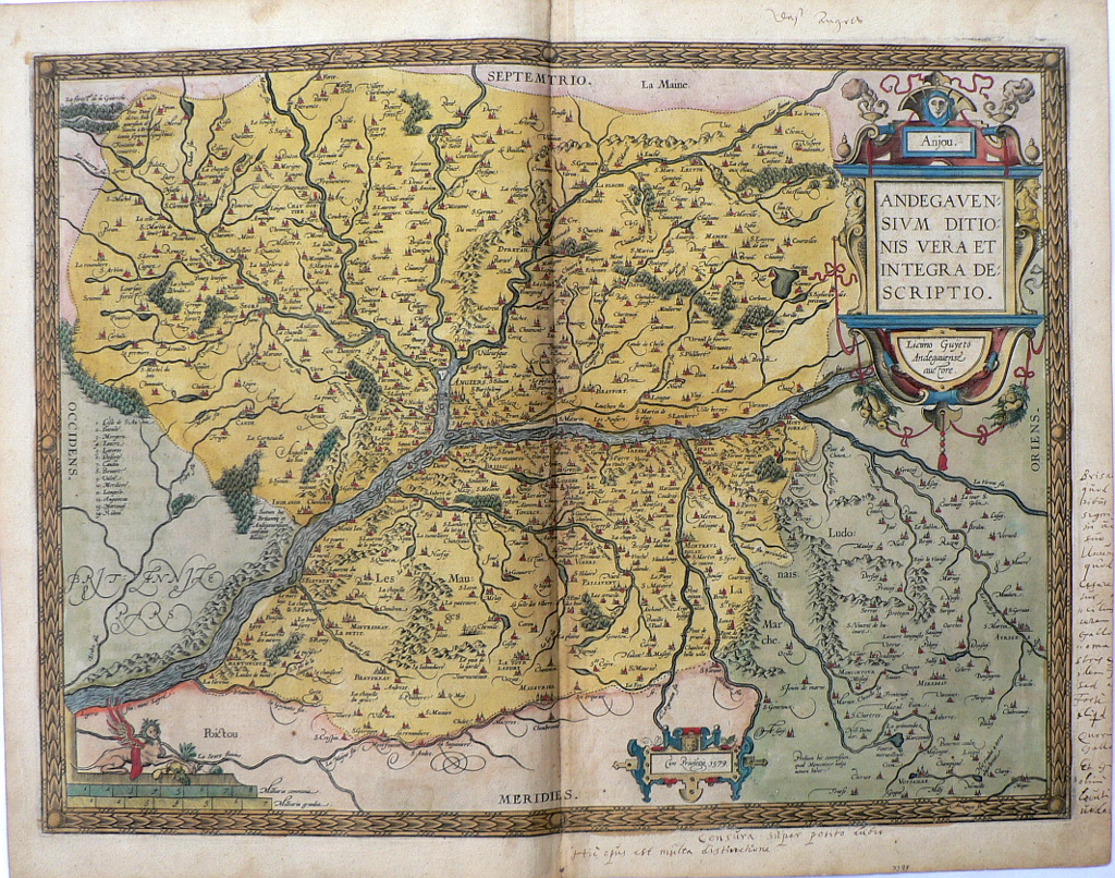
“Anjou. Andegavensium Ditionis Vera et Integra Descriptio.”
Abraham Ortelius (1527-1598) was a Dutch geographer and cartographer who is generally acknowledged as the creator of the first modern atlas; the first uniformly sized systematic collection of maps. His maps were issued colored and uncolored, but when the original color has been preserved such as in this example, it is beautifully and distinctively applied. Decorative strapwork surrounds the titles, and scales. Topographical details such as forests and mountains are shown as are cities with their relative sizes denoted by the number of buildings, spires and walls that are shown.
This wonderfully detailed map depicts the course of the Loire as it passes through Anjou with Angers (Angiers) at the center of the image, Poitiers (Poitou) to the south and as far west as Chinon. Every settlement of any size is shown including such familiar towns as Saumur, Brissac, Trenes, and Usse.
As RV Tooley notes in Maps and Mapmakers, “For accuracy according to the knowledge of their time, magnificence of presentation and richness of decoration, the Dutch maps of this period have never been surpassed.”
16 x 20 inches, sheet.
Copper plate engraving with original coloring.
Excellent condition with ancient notations in gall ink in margins.
or click to inquire about this print.