
(Coast of France and The Loire) Abraham Ortelius. Amsterdam, ca. 1590. $550.00
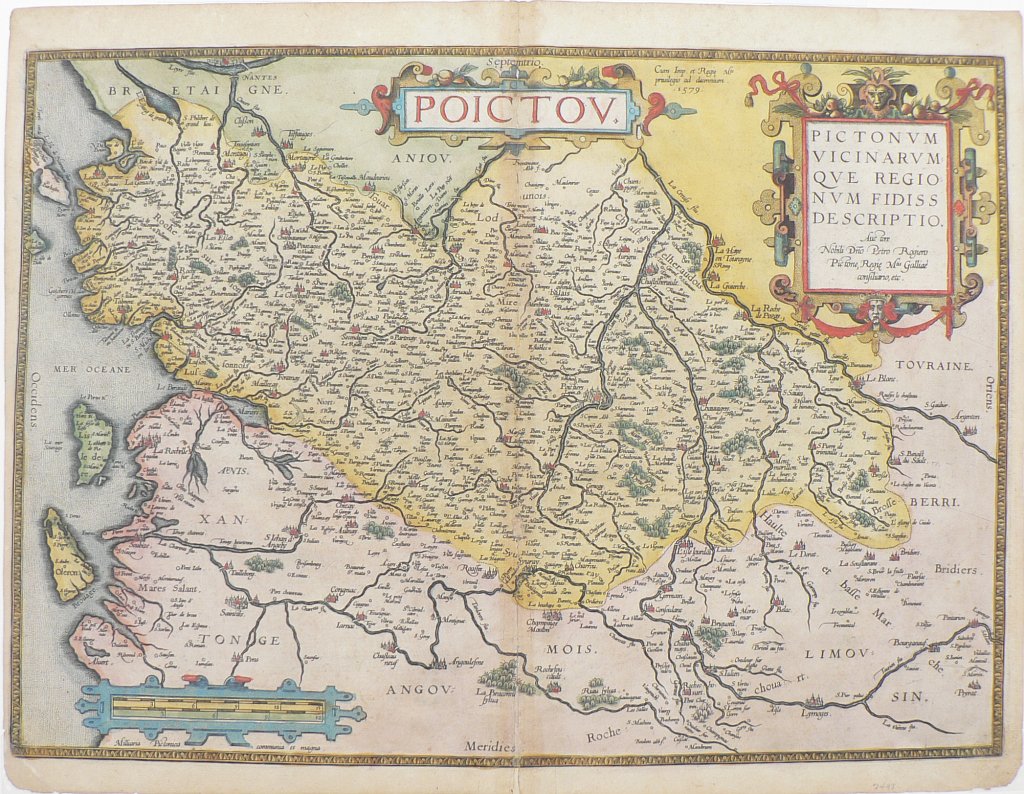
“Poictou. Pictonum Vicinarum Que Regionum Fidiss Descriptio.”
Abraham Ortelius (1527-1598) was a Dutch geographer and cartographer who is generally acknowledged as the creator of the first modern atlas; the first uniformly sized systematic collection of maps. His maps were issued colored and uncolored, but when the original color has been preserved such as in this example, it is beautifully and distinctively applied. Decorative strapwork surrounds the titles, and scales. Topographical details such as forests and mountains are shown as are cities with their relative sizes denoted by the number of buildings, spires and walls that are shown.
This wonderfully detailed map of the coast of France including La Rochelle and Nantes and extending inland to include important wine making areas such as Cognac, Chateau Neuf and St. Emilion and familiar chateaux towns including Rochefort, Saintes, Fontenay, Angouleme, etc.
As RV Tooley notes in Maps and Mapmakers, “For accuracy according to the knowledge of their time, magnificence of presentation and richness of decoration, the Dutch maps of this period have never been surpassed.”
16 x 20 1/4 inches, sheet.
Copper plate engraving.
Very good condition with original coloring.
or click to inquire about this print.