
Bowen, Emanuel....Canaan... London, c. 1760 $250.00
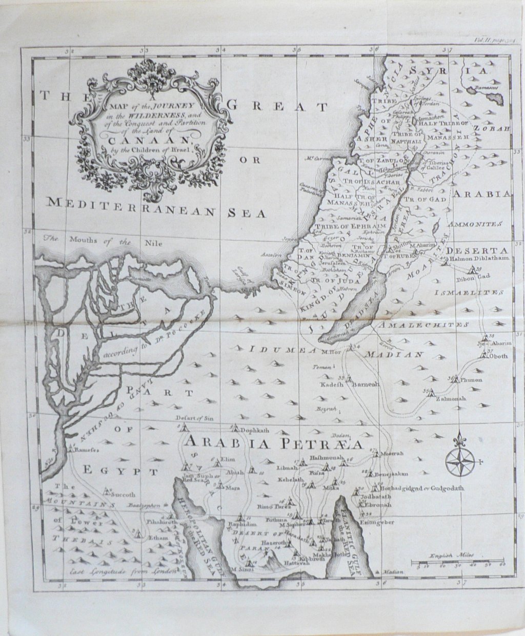
“Map of the Journey in the Wilderness, and the Conquest and Partition of the land of CANAAN by the Children of Israel”
Emanuel Bowen (1714-1767) was a London print and mapseller who achieved considerable success with his detailed maps. Particularly noteworthy among these are his British road maps, his map of the American colony of Georgia and his depiction of Bermuda.
This very detailed map shows the portions of the “fertile crescent” along the Nile, through the Israelites promised land of Canaan, and extending into parts of Egypt, Jordon, Syria and the Arabian dessert; the part of the world that was and is at the crossroads of Judaism, Christianity and Islam and vitally important to each of the 3 faiths. Bowen’s map shows historical placenames, the territories of the 12 tribes, grouped into the southern kingdom of Judea and the northern kingdom of Israel, and the Roman partitions of Judea, Samaria, Galilea, Traconitea, Perea and Idumea.
13 ¾ x 11 ¼ inches, sheet.
Copperplate engraving.
Excellent condition save trimmed to plate on left margin.
or click to inquire about this print.