
(Ottoman Empire) Chiquet, Jacques. Paris, 1719. $295.00
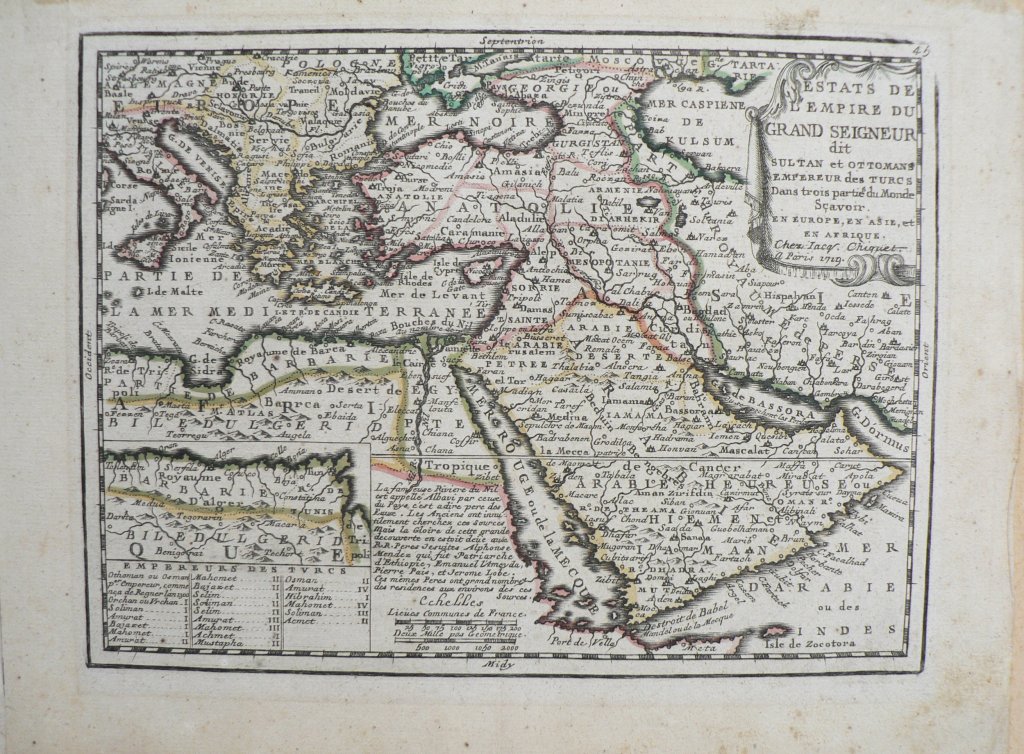
“Estats De L’Empire Du Grand Seigneur dit Sultan et Ottomans Empereur des Turcs…En Europe, en Asie et en Afrique.”The French cartographer, Jacques Chiquet (1673-1721) published only two atlases, both in Paris in 1719, so his work is rare. The title of the atlas in which this map appeared, Le nouveau et curieux Atlas Geographique et Historique, ou Le Divertissement des Empereurs, Roy et Princes…, implies that the atlas was created for royals. His maps are well drawn in a style and with the decorative flourishes typical of 18th century French work. They contain a great deal of detail including observations concerning important historic events in the regions. The mapmaker expanded on his historical and personal observations in the long page of accompanying French text.
This pretty map depicts the extent of the vast extent of the Ottoman Empire from the Balkans to Persia, including all of Arabia and North Africa (with a detailed enlarged inset of the coast of North Africa.) The key below names all of the Ottoman rulers.
At the time that this map was published, Russia had become a major European power under Peter the Great.
8 1/8 x 11 ¼ inches, sheet.
Hand colored copperplate engraving.
Original outline coloring.
Overall patina and some soiling of margins, not affecting image.
Complete with page of accompanying text.
or click to inquire about this print.