
(Borough of Downingtown) Plate 26. A.H. Mueller, 1912. $295.00
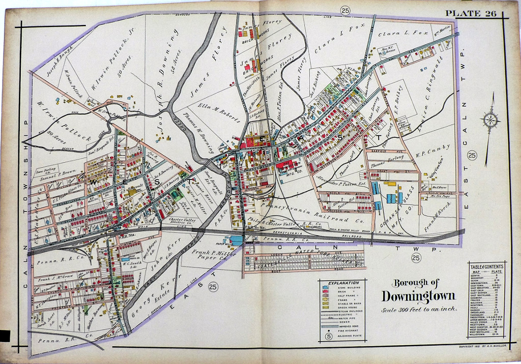
Plate 26 (Borough of Downingtown)
A detailed large scale, colored and keyed map from the Property Atlas of the Main Line Pennsylvania R.R. from Devon to Downingtown and West Chester published by A.H. Mueller in Philadelphia in 1912. The maps included owner's names, types of contruction - frame, brick, stone, stucco, iron or iron clad - garages, stables and outbuildingsas well as the location of mines, quarries, steam railroad lines and paved, unpaved and private roads.
This map shows the Brandywine Creek running to the west of the center of town at the center of the map. Many commercial and industrial complexes are shown including the U.S. Plate Glass Co., the Pennsylvania Railroad, and P.R.R. station, the Frank Miller Paper Co., the Downingtown Machine Shop and Foundry, the Brick Works, and Cohansey Glass Manufacturing Co.
Please contact us for photographs and descriptions of other maps from this atlas showing Willistown, West Whiteland, West Goshen, West Chester, Valley Forge, Upper Merion, Tredyffrin, Swedeland, Radnor, Newtown, Malvern, Frazer, Edgemont, East Whiteland, East Gosher, East Caln, East Bradford, East Town, Downingtown, Devon, Bridgeport and Berwyn.
22 1/4 x 32 inches, sheet.
Excellent condition backed with linen as issued.
or click to inquire about this print.