
(East Bradford) A. H. Mueller. Pl. 24. Atlas ... from ...Devon to Downingtown and West Chester. Philadelphia, 1912. $295.00
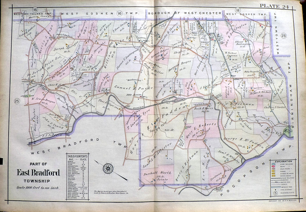
"Part of East Bradford Township"
We have a large selection of large scale maps of properties (residential, commercial, and institutional) that extended along the tracks of the Pennsylvania Railroad between Devon to Downingtown. The maps contain fascinating information about property owners, types of buildings on the properties with frame, brick, barns, stables, green houses all shown, sewer lines, steam railways, electric railroads and “macadamized” roads. This map was included in a particularly beautifully colored atlas.
The Brandywine Creek runs horizontally through the center of the map. Details include Harmony Hill, Copeland, and Sconnelltown schools and Lenape Park and Hiawatha's cabin along the Brandywine as is Jeffers Bridge erected over the ford where General Cornwallis crossed the river during the Revolutionary War.
22 x 31 ½ inches, overall.
Hand colored lithograph.
Excellent condition
or click to inquire about this print.