
Wyndmoor. Philadelphia: G. M. Hopkins, 1877. $225.00
"Plan of Chestnut Hill"
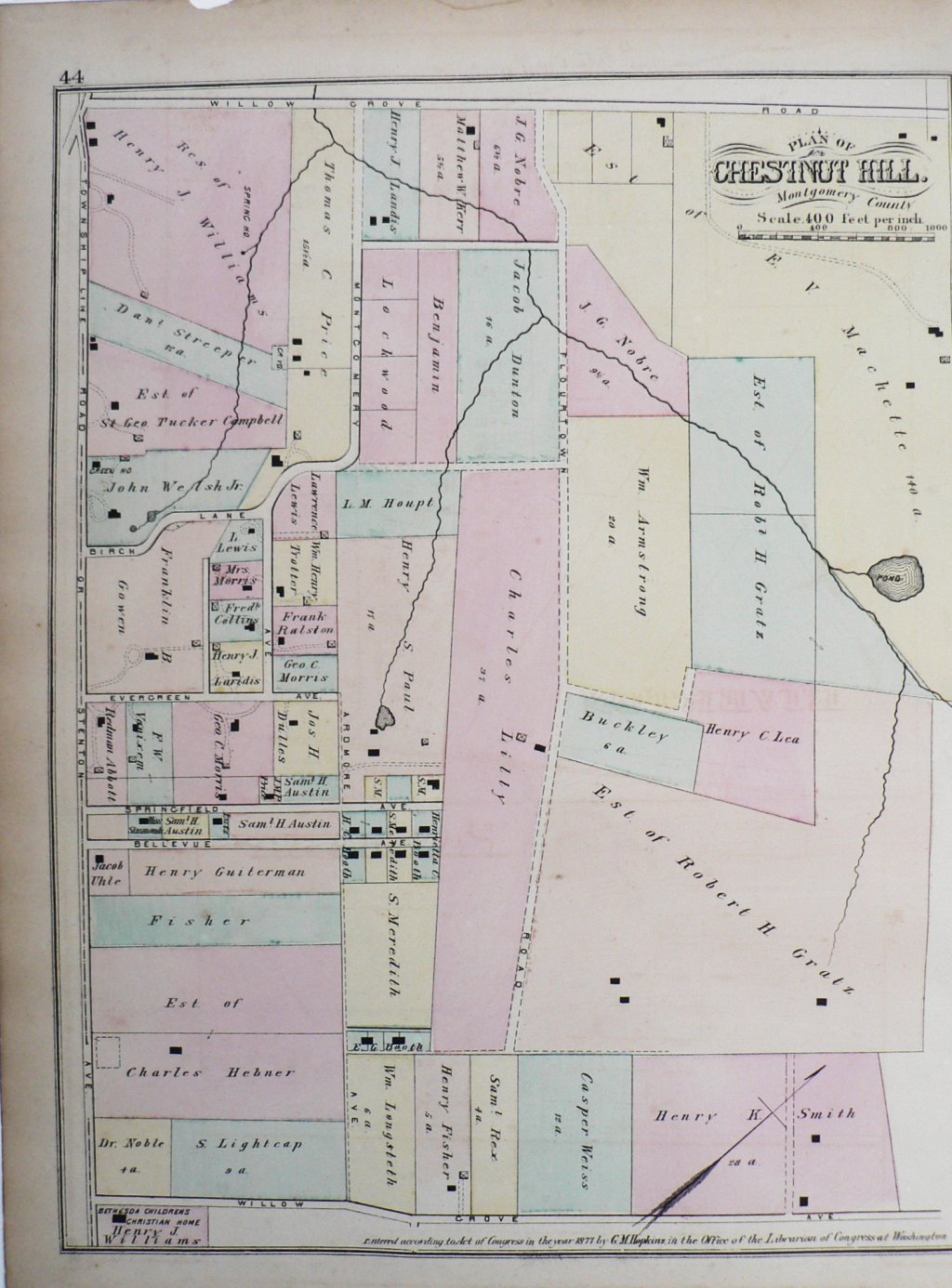
This beautifully colored large scale 1877 antique map shows Chestnut Hill This hand colored lithographed 1877 map of Chestnut Hill, Montgomery, Co. shows the area extending between Stenton and Willow Grove Avenues
just north of Township Line Road. It includes stretches of Springfield, Bellevue, Evergreen, and Flourtown roads showing the large estates that occupied the land at the time.
Hand colored lithograph.
17 1/4 x 13 inches, sheet.
Very good condition wave small chip in margin at upper left,
or click to inquire about this print.