
(Chester, UK) Braun and Hogenberg, Cologne, ca. 1572. $1,650.00
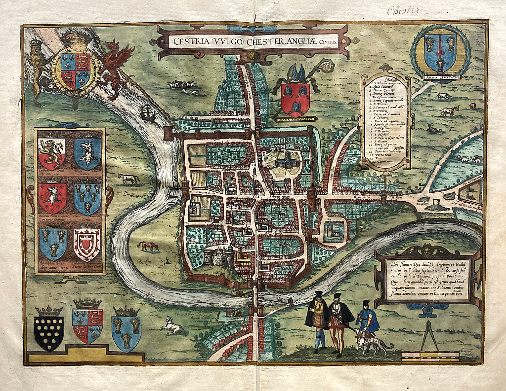
"Cestia Vulgo Chester, Angliae civitas"
This view of the English border city of Chester was included in Civitates Orbis Terrarum, the first systematic series of city views, published in Amsterdam between 1572 and 1617. This great work included bird’s-eye views and map of all major cities in Europe, plus important cities in Asia, Africa, and Latin America; all the known world at that time. Edited and annotated by theologian and publisher Georg Braun with most plates engraved by Franz Hogenberg, the Civitates was intended as a companion volume for Abraham Ortelius’s 1570 world atlas, Theatrum orbis terrarum. Over a hundred different artists and cartographers contributed to the sumptuous artwork, which not only shows the towns but also features additional elements, such as figures in local dress, ships, ox-drawn carts, courtroom scenes, and topographical details to help convey the situation, commercial power, and political importance of the towns depicted. These views provide wonderfully comprehensive views of urban life at the turn of the 17th century.
Chester is a Cathedral City on the River Dee close to the English /Welsh border, an ancient town founded by the Romans as a main army camp in 79 AD. This magnificent original hand colored engraving details the walled city and its gates as well as cathedral and churches with small houses ringing green garden spaces, horses and cows grazing outside the town walls. Male figures in flower right foreground in contemporary costume. The top left cartouche features the British rampant lion and Welsh dragon.
Copperplate engraving with full original hand color.
16 x 21.5 sheet size.
Excellent original condition.
or click to inquire about this print.